Sars Son
Porirua is one of the four cities that constitute the Wellington, New Zealand, metropolitan area; thus it is considered a part of Wellington as a whole. It is largely formed around the arms of the Porirua Harbour, the coastline facing out to Cook Strait and the north-eastern parts of the South Island. Most of the populated areas of Porirua are coastal: Camborne, Karehana Bay, Mana, Onepoto, Papakowhai, Paremata, Pauatahanui, Plimmerton, Pukerua Bay, Takapuwahia, Titahi Bay and Whitby all have direct access to coastal parks and recreation reserves. Several suburbs without direct coastal access, including Aotea, Ascot Park and Ranui Heights, have substantial portions with good views over the harbour. Elsdon, formerly known as Prosser Block, lost access to the harbour as a result of reclamation work, especially during the 1960s. Much of the existing city centre, north of Parumoana Street and east of Titahi Bay Road, was built upon this landfill.
* indicates district photo albums - go to links below
* indicates the suburb does not have its own album but photos of that area will be found in one of the other albums (usually in Porirua general)
The suburbs include the following
.. grouped by council ward ..
Eastern Ward
* Aotea - Only 10 people lived in the area in 1996. With new housing developments, the population increased to 120 in 2006 & 270 in 2018
* Ascot Park
* Cannons Creek
* Porirua East
* Ranui Heights
* Waitangirua - established in the 1960s
Northern Ward
* Camborne - developed from the 1960s
* Golden Gate "“ a local name for the eastern part of Paremata
* Hongoeka Bay "“ a NgÄti Toa settlement
* Judgeford "“ a rural locality
* Karehana Bay
* Mana - bounded by the entrance to Porirua Harbour and the
* Pauatahanui inlet of Porirua Harbour
* Paekakiriki Hill - for some of the best views in the district
* Papakowhai "“ where kowhai trees are prominent on headlands
* Paremata "“ name from the "Paremata Barracks", erected on the north shore of Porirua Harbour about 1846
* Pauatahanui - the road from Wellington reached Pauatahanui in Sep 1848
* Plimmerton "“ named for a director of the railway company
* Pukerua Bay "“ where film-maker Peter Jackson grew up
* Whitby "“ street names commemorate James Cook
Western Ward
* Elsdon "“ named after writer Elsdon Best
* Kenepuru "“ industrial area south-west of the centre, adjoining Linden
* Mana Island - predator-free, bird sanctuary island, off the coast of Porirua
* Onepoto - translates as "short beach"
* Porirua Central "“ Porirua's central business district
* Takapuwahia "“ a NgÄti Toa settlement
* Titahi Bay "“ where pro golfer Michael Campbell grew up
The Suburbs in Photo Albums
JUDGEFORD
photo Judgeford floods in 1959 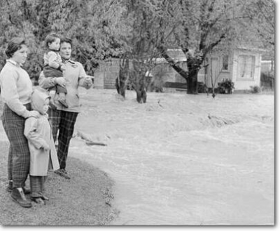
MANA Island
.. includes Mana
photo Mana Esplanade 1964 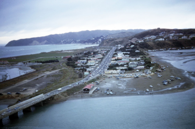
PAEKAKARIKI Hill
.. includes Paekakariki in general
photo from Paekakariki Hill 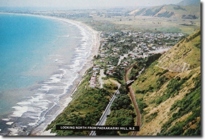
PAREMATA
photo crossing Paremata bridge 1936 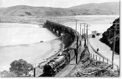
PAUATAHANUI
photo Pahautanui main street 1903 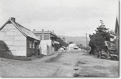
PLIMMERTON
photo winter in Plimmerton 2005 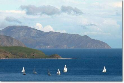
PORIRUA general
photo Cannons Creek 1966 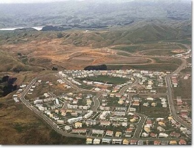
PUKERUA Bay
photo building Centennial Highway, Pukerua Bay to Paekakariki 1939 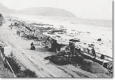
TITAHI Bay
photo Titahi Bay beach 1930s 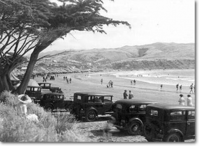
WHITBY
photo Whitby 2007 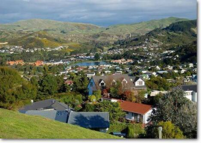
PHOTO
Speedboats on Porirua Harbour 1955
No comments yet.