itellya on Family Tree Circles
Journals and Posts
JOSEPH HARPER, WHEELWRIGHT, SPRINGS (near Keilor), VIC., AUST.
Joseph Harpen, the Springs
I was wondering if you have ever come across a Joseph Harpen of the Springs during your research? My great grandmother Catherine Guilfoyle was an Irish orphan assigned to him in 1849. In addition, Susan Guilfoyle was assigned to James Robertson of Portland in 1849. Do you know if he is connected to the James Robertson of La Rose?
Marcia, Ignore the first paragraph.
It's not much fun researching HARPEN on trove because most results are for happen, Harper and sharpen. I was going to link Harpen with Keilor or Doutta Galla but there seemed little prospect of getting a result, and based on one result and your mention of Portland,I entered Camperdown and Springs. There were probably scores of properties and places called Springs and it is possible that Joseph Harpen was at Springs near Camperdown.
Given that there were three totally unrelated James Robertsons within a few miles of Essendon (La Rose and Trinifour near Essendon; Upper Keilor and Aberfeldie; and Gowrie Park near Campbellfield), I would not even dare to suggest a relationship between Jimmy of Portland and the others. But you never know!
HANG ON, HANG ON, HANG ON!!!
What if the name of Catherine's employer in 1849 was Joseph HARPER? Joseph Harper was the wheelwright at the Springs in 1848 and 1849 and was up on a charge of dudding a servant. This does not mean that he was on the Foster estate stretching from Tullamarine to Keilor Park and if it did, there was no indication whether he was at the north end like David O'Nyall of the Lady of the Lake or on the road to Keilor.
For the delivery of the above mares and cattle, separately or conjointly to the under-signed, or Mr. Joseph Harper, Wheelwright at the Springs, the following rewards will be paid viz. :-?2 for the mare without foal and each of the three bullocks ; and 3 pounds, for the mare with foal.
WILLIAM O'NEIL,
Springs, Mount Macedon Road. September 19, 1848. (P.3, Argus, 26-9-1848.)
Mount Macedon Road doesn't help much to specify Harper's location because it was used to describe the road to Keilor and the one to Deep Creek (Bulla), and even Pascoe Vale Rd (the road to Sydney past the Young Queen Inn.) However William O'Neil is another matter.
A former policeman, called Gay Lothario in Angela Evans'"Keilor Pioneers: Dead men do tell Tales",William leased "Leslie Banks" from the Fosters for many years; Leslie Banks was across Fosters Rd (now Keilor Park Drive) from Springs, on the Maribyrnong River's banks, between the lines of Sharps Rd and Spence St. Soon after, the part of the Keilor Township in today's Horseshoe Bend Park was alienated in 20 acre lots, with lawyer F.D.Wickham securing most of them, but William O'Neil soon owned all of the horseshoe bend. This makes it likely that William O'Neil and Joseph Harper were operating on the road to Keilor rather than today's Melrose Drive.
It seems that Joseph Harper had moved to Kyneton by 1856.(P.5, Argus, 25-10-1856.)
He may have been an innkeeper at Woodend in 1852:
CAUTION.
LOST on the (I8th?) of November, between the Five Mile Creek, Mount Macedon, and Jackson's Creek, Two Cheques on the Union Bank of Australia. One on the 4th November, No 23, for ?215/10 s. do. on tho 10th, No 43, for?215/15s; drawn in favor of Joseph Harper,innkeeper, of the Woods End Inn, Five Mile Creek. (etc.)
(Signed) JOSEPH HARPER. (P.8, Argus, 16-11-1852.)N.B. WOODS END looked like WEEDS BAD, due to a surplus of ink, so I hope my guess was right.
JOSEPH PORTA: the first manufacturer of bellows in Victoria, Australia.
Joseph Porta was of Italian origin but his family was resident in England, perhaps near Birmingham, and he emigrated to Victoria from there.By about 1861 he had received the grant (title from the Government) for Crown Allotment 63 Moorooduc near Somerville. Within a couple of years he became insolvent and became a cab driver in Mornington by 1866. In this year he was also making bellows, probably in Mornington. As the PORTAMOULDINGS company history explains, he established his Little Lonsdale St factory in Melbourne in 1868.
I have extensive information from Trove which I am willing to provide to people who have read the PORTAMOULDINGS website.Joseph's family was related by marriage to the Bennetts of Mornington.
JOSEPH WILLIAM HAZLEDINE OF PICOLA, ROSEBUD AND DROMANA, VICTORIA, AUSTRALIA.
JOSEPH WILLIAM HAZELDINE (sic) OF ROSEBUD AND DROMANA.
This journal is based on my post of August 11, 2015 on the HISTORY OF DROMANA TO PORTSEA Facebook group page, followed by many Hazledine descendants (who informed me that the usual "el" spelling, which I've deliberately left in the title of the post, is wrong.) At the time having conducted special rate research, I attempted to submit a journal but internet connection issues prevented this.
Joseph William Hazledine Jnr. married Lizzie, daughter of Rye's Michael Cain, and many Hazledine descendants still live in the area. One, John, wrote an article in the Rye Historical Society's White Cliffs which includes a photo of J.W.H.Jnr, his son (Neville) and grandson (John.)
'White Cliffs' - Rye Historical Society - Weebly
ryehistoricalsociety.weebly.com/.../july-august-september_2013_color.p...
.... My father's name was Neville Joseph Hazledine.
From A Dreamtime of Dromana.
P.67. On 22-11-1888,Mr Hazeldine's black mare was served by George McLear's Gay Lad and left in the paddock with him. The horse was required in about a fortnight for drill practice. (G.McLear's account book.)
P.53-4. When H.B.Simon died, his house, which was situated about 230 yards above Boundary Rd, was purchased by the Shire Rate Collector, Mr Hazeldine, who moved it onto his land in Foote St, Dromana and with his family took up residence therein. His descendants occupied it until comparatively recently (stated Colin)when it was removed to make way for the new Roman Catholic Church.
P.166. Ticky Hazeldine was a member of the Dromana footy team in 1946 and is in the back row in this photo.
P.195.Ticky Hazeldine delivered meat orders on his horse and cart.
SHEPPARTON, MONDAY.
At the ordinary monthly meeting of the Shepparton Shire Council today a letter was received from Mr. Charles W. Morgan, of Echuca, on behalf of Mr. J. W. Hazeldine, State school teacher at Picola North, applying for the payment of £250 for a libel contained in a letter written by the secretary of the council to the Minister of Public Instruction in November, 1882, in connexion with rates due to the council. It was resolved to place the matter in the hands of the shire solicitor.(P.7, Argus, 3-7-1883.)
POULTRY.-Cochins-First, J. W. Hazeldine, Picola.Common Cochins-First, A. E. Kinsey; second. J.W. Hazeldine. Dorkings-First, J. W. Hazeldine.
White-crested Polish-First. A E. Kinsey. Polish (othervariety)-First, J. W. Hazeldine. Black Spanish-First, A E. Kinsey; second, J. W. Hazeldine. Bantams First, James Malono, Moama. Golden Hamburgs First. J. W. Hazeldine; seoond, T. Taylor. Silver Hauibunra-First, T. Taylor. Silver-spangled Hamburgs-first, J. W. Hazeldine; etc.(P.31, The Australasian, 15-8-1885.)
BOARDS FOR HEARING OF REASONS AGAINST FORFEITURE OF LICENCES. [coming soon]
Leader (Melbourne, Vic. : 1862 - 1918) Saturday 19 October 1889 p 9 Detailed Lists, Results, Guides
... — Benjamin White, 133 a., Kunat ICunat. Echuca, 29th October, at 10 a.m.— Joseph W. Hazeldine, 11 a., Picola,
DROMANA.
The ordinary fortnightly meeting of the Literary Association was held on Monday
last in the Mechanics' Institute. The proceedings took the form of a mock parliamentary election. There were five candidates desirous of representing the electors of the County of Mornington. Messrs Brady and Wright stood in the Free trade interest, whilst Messrs Hazeldine and Heather were Protectionists, and Mr T.Chapman was the nominee of the Temperance party.
(P.3, Mornington Standard, 19-10-1889.)
When the late John Vans Agnew Bruce Jnr's northern portion of Jamieson's Special Survey (from coast to Bulldog Creek Rd between lines indicated by Ellerina Rd and Martha Cove Waterway) was advertised for sale, Joseph William Hazeldine, was the local agent.
It is part of the celebrated Jamieson's Special Survey, in the parish of Kangerong, and the land will be pointed out by the driver of the coach from Mornington to Dromana, or by Mr J. W. Hazeldine, electoral registrar and agent, Dromana. (P.2, Mornington Standard, 26-12-1901.)
Mornington Peninsula Football Association.
A meeting of delegates of the above Association was held at the Grand Hotel, Mornington, on Monday night last, the president (Mr L. Harrison) in the chair. The following delegates were also present :-Messrs W Odgers and T. Hutchins (Mornington), H.Firth and W. Monk Somerville), J.Griffith and Hazledine (Dromana), Oswin and Callanan (Balnarring), Pearce and Wilson (Hastings), H.Noble and McLaurin (Tyabb), A.Bartlett (Sorrento).
In the absence of Mr H. Menck (who is at present in ill-health), Mr Hazeldine was appointed secretary pro tern, on the motion of Messrs J. Griffith and H.Firth. etc. (P.3, Mornington and Dromana Standard, 21-8-1909.)
DROMANA.-CORIO, superior Accommodation, near beach and golf-links; terms moderate; garage. Mrs. Hazeldine. (P.12, Argus, 28-3-1916)
So Joseph's wife, Mary Margaret Hazeldine (nee Hamilton?), former teacher, really did become a boarding house keeper!
OBITUARY
MR. J. W. HAZELDINE.
The death occurred on Friday of Mr. Joseph William Hazeldine, aged 82 years, at his residence, Dromana. Mr. Hazeldine settled in the Dromana district 48 years ago and was a State school teacher at Rosebud for NINE* years. He was a teacher in the service of the Education Department for 28 years. Until his death he was registrar of births and deaths at Dromana. The funeral took place on Saturday. Requiem mass was celebrated by the Rev. Father O'Sullivan, who also read the burial service.
Burial took place in the Dromana cemetery**. The casket was carried by his six sons. The pall-bearers were Cr Wilson, Messrs. A. W. Farrell, L.Carrigg, J. Matthews, A. Cooper, B.Wilson, J. Moraes, and G. Brown. The funeral was conducted by Mr Hector Gamble, of Frankston. Mr. Hazeldine leaves six sons and four daughters.(P.1, Frankston and Somerville Standard, 30-8-1935.)
* From my ROSEBUD POST OFFICE post.
LOUIS ANDERSON AND JOSEPH WILLIAM HAZELDINE.--------Louis Anderson was appointed postmaster at Rosebud on 22-9- 1890, following the resignation of teacher Joseph William Hazeldene who started at Rosebud State School on 20-9-1886 and conducted a post office at the school (as he had done at Picola) from 38-3-1889 to September 1889, retiring as a teacher at the end of the year. "Although Louis Anderson was postmaster for the next seven years, regretably no one today has ever heard of him. Early records of the school show that the post office continued to be conducted from the school and the head teacher who replaced Mr Hazeldene at the beginning of the school year in 1891, Mr Frederick Cooper Green, was appointed postmaster on 11-5-1897 and continued in the role, despite the control of Post and Telegraph passing to the Commonwealth on March 1,1901, until he left the school at the end of 1901.
(The above would indicate that Joseph William Hazeldine was at Rosebud State School only for four years. However 48 years before 1935 would have been 1887 and he might have started at the school then. It is also possible that Mr Green started at Rosebud State School in 1897 and the last digit has been misread as a 1. However the latter theory is disproved by the following extract from the report of a Flinders and Kangerong Shire meeting.
BOARD OF HEALTH.
A. G. Clayton, teacher, Flinders, wrote asking permission to re-open his school, which had been closed owing to prevalence of whooping cough.- There being no objection on the part of the health officer, the re-opening wassanctioned.
From F. Green, Rosebud, reporting two cases of whooping cough. Received.
(P.2, Mornington Standard, 7-4-1892.)
The obituary indicates that Joseph's wife, Mary Margaret, had pre-deceased him so the information would have come from their children. It is possible that it was Mary Margaret Hazeldine who taught at Rosebud State School for nine years. Her occupation was given as teacher as late as the 1910-11 assessment (and perhaps in 1911-12 which I skipped) before her description changed to boarding house keeper in 1913-14.
**DROMANA CEMETERY.
These are the only Hazeldine details recorded from headstones.
HAZELDENE Barbara M 11/10/1941 9/08/1993 Hus Edwin
HAZLEDINE Robert Roy 18/08/1948 18/07/1993
HAZLEDINE Ronald Roy 6/05/1921 25/03/2000
HAZLEDINE Doris Lillian 2/03/1918 11/08/2002
It could be assumed that Mary Margaret was also buried at Dromana. Their headstone was probably destroyed by the terrible 1939 bushfire.
History - Rosebud Primary School
www.rosebudps.vic.edu.au/index.php?option=com_content...1...
The Education Department announced in November 1886 that a school house with a teacher's residence attached would be built on the recently acquired land. The plan of this building was the standard design being built throughout Victoria in this era. It consisted of a 24 foot by 16 foot school room with iron gable roof and a small gabled front porch. A four-roomed teacher's residence was attached running at right angles to the school room. A skillion verandah ran the length of the dwelling. The whole building was clad in weatherboards.On April 7th, 1887 the school furniture was moved from the leased building and placed in the new schoolhouse. Presumably the Head Teacher, Mr Joseph Hazeldine, moved into the residence. He had four school-age children of his own enrolled at the school.
About this time, wandering cattle were a problem because they liked to sleep the night in the shelter of the school building. The school site was bare of vegetation and Mr Hazeldine promised to plant shelter trees if the Department would fence the property to keep out the cattle. In 1888 a split post fence with three rails was built around the school site. It had a large and small gate facing the Main Road and cost £26, half of which was paid with local funds.
A large rotting stump of a cypress tree just inside the front fence is all that remains of Mr Hazeldine's "shelter" trees.
ABOUT THE HAZELDINES.
Comment from Jenny Skelton.
Dad told me about a man called 'Ticky' Hazeldine when I showed him my form 2 photo from High school, he went on to say that 'Ticky' had heart problems, (thus the) nickname. He worked for my uncle Jack Wilson Butchers.
N.B. Melbourne Brindle's map of Dromana shows that Ewart called one of his friends "Chap Hazie". This was probably one of Ticky's brothers.
We've seen one of Joseph's interests, which probably provided much eggscitement. He should have sought counsel before taking on this old adversary, but there again counsel WAS his adversary.
A chess match between two old antagonists, Mr Frank Counsel and Mr J.W. Hazeldine, which had been pending for some time was played last week. The conditions were the best 4 games out of 7. Mr Counsel proved too good
for his opponent, winning the first 4 out of 6. Mr T. Bryan acted satisfactorily as umpire. (P.2, Mornington Standard, 5-5-1898.)
JOSEPH'S FRIENDS.
One would assume that his pall bearers were among his closest friends,i.e.
Cr Wilson, Messrs. A. W. Farrell, L.Carrigg, J. Matthews, A. Cooper, B.Wilson, J. Moraes, and G. Brown. Cr Wilson would have been Henry Burdett Coutts Wilson whose son almost drowned at Dromana circa 1906 while he and Mr Townsend (who saved the boy using mouth to mouth half a century before it was invented) were building the slaughteryard shown on Melbourne Brindle's map. Henry took charge of the Sorrento butchering operation after acting as a footy umpire (as Joseph also did.) B.Wilson would have been Ben. A.W.Farrell served as Shire Secretary of the F & K and Mornington Shires; he is in the photo (displayed in the Dromana Museum) taken in 1928 when the Old Shire Office was first used. Lou Carrigg owned the Dromana Hotel from about 1914 and remodelled it in 1927; he was a stalwart of the Dromana Football Club and Joseph served as the club's delegate. James Matthews was an early builder who married a descendant of Sarah Wilson as detailed in Petronella Wilson's GIVING DESTINY A HAND, and was badly injured. A. Cooper, whether the surname was spelt Cooper or Couper, was probably a Rosebud pioneer. (Ramsay and Nora Couper were early owners of The Thicket.) John Lima Moraes may have been another Cape Verde Islander; In 1910 he was farming on 10.5 acres on 31A Wannaeue (southern portion of Rosebud Public Golf Course) and in 1919 he was also farming another 53 acres nearby, possibly William Hobley's grant, now occupied by Firway Grove and Burunda Rd. G.Brown was possibly a son of Charles Brown who was running the Arthurs Seat hotel when it burnt down in early 1898.
THE TWO HAZELDINE HOUSES IN DROMANA.
When Joseph retired from teaching and moved to Dromana, possibly in early 1897,he leased crown allotments 1 and 3 of section 2, Township of Dromana from J.F.Hughes of Castlemaine. Crown allotment 3 had a 20 metre frontage to both Foote St and McArthur St starting 40 metres from the Esplanade and was granted to Alexander Haldan on 16-11-1859. Crown allotment 1 on the western corner of the Esplanade and Foote St was purchased from the crown by R.Walker and W.D.Scurfield on 10-5-1858 but had probably been sold at a tidy profit to Haldan soon afterwards because Alex. was running the township's post office by the end of 1858. Scurfield's hotel was erected at the same time on the east side of Foote St and being run by Richard Watkin (who later established the Dromana Hotel in 1862)by the end of 1858, in conjunction with selling Arthurs Seat timber.
In the mid 1880's, there was a petition organised by George McLear to extend the township's eastern boundary from McCulloch St toward the pier but such a formality wasn't needed when Walter Gibson took over the position of post master and constructed a granite post office fronting the Esplanade not far west from Pier St and Rudduck's Jetty Store. The Haldans ran a guest house called Dromana Villa in the old post office. The building was later owned by George Dawes, who used to buy gold, but he had a serious accident and sold it to Hughes.
So it was Dromana's original post office, probably enlarged to become a guest house, which the Hazledines occupied from 1897 until 1902 when Joseph's name was written under occupant but then crossed out. Melbourne Brindle noted that pre-1918 the house was called Carnavon and occupied by Ricketts, later Hughes.The house survived until the 1950's when it was replaced by a granite house called Carnarvon. The Flemmings found many ink wells in the garden; there weren't biros 1858-1886! A modern building now stands on the west corner of Foote St where the Hazledines first lived in Dromana but the second Carnarvon was not demolished, instead being extended with a granite wall still visible under the carport.
In 1903, Mrs J.W.Hazledine was assessed on 5 lots and building, Dromana. The 1907 rates describe Mary Margaret Hazledine as a teacher who was assessed on 3 lots Foote St, while Joseph, who'd apparently sold 8 acres to Nelson Rudduck, was leasing, or had maybe bought, 11 acres (McRae, sic Estate) from law firm, Stribble. Some of McCrea's land was the site of their second house, "Corio", H.B.Simon's old house.
MARY MARGARET HAZELDINE'S BOARDING HOUSE.
It is mentioned above that in 1906-7 Joseph William Hazeldine was assessed on 11 township lots, a note indicating that this was the McRae Estate.Early in my research, I thought Dr McCrae might have been Dr Farquhar McCrae, the brother of Andrew McCrae of the Arthurs Seat Run. I now know that it was this fellow.
Biography - William McCrea - Australian Dictionary of ...
adb.anu.edu.au/biography/mccrea-william-4072
William McCrea (1814-1899), medical administrator and naval surgeon, was born on 14 October 1814 in County Tyrone, Ireland. His father died before William.
I will not detail the location of all of his grants in Dromana Township, just the ones in connection with the boarding house.
1913-14.
Mary Margaret Hazeldine, boarding housekeeper, 1.5 acres and building,crown allotments 7,8,10 section 1.
Section 1 was bounded by the beach road, Permien St,Clarendon St and Foote St. Many blocks near the Beach Road were granted to William Dixon Scurfield whose hotel was being run by Richard Watkin by 1858. Crown allotment 7, 8 and 10 were granted to Dr William McCrea in August 1856.
C/A10 had frontages of 50 metres to the north side of Clarendon St and 40 metres to the east side of Foote St. Lots 8 and 7, each having a frontage of 20 metre to both Foote and Permien Sts were north west of lot 10 (and 9 on the Clarendon/ Permien corner.) Lot 10 is now the site of Our Lady of Perpetual Help Catholic Church, the new Catholic Church for which the Hazeldine home was demolished, that is, the former home of Henry Bernard Simon mentioned at the start of this post. As seen above in an advertisement, the boarding house was called "Corio".
Melbourne Brindle's map calls this "Chap" Hazeldine's house. In the middle of lots 8 and 7 is a cross linked by an arrow to the following text: SCENE OF THE CHAFF CUTTING CONTEST OF THE CENTURY. OLD "DAD" (NOT TOO BRIGHT) WAS THE VICTIM - CHAP HAZEY WAS THE MASTER-MIND!
HAZELDINE. — On the 13th November, at her residence,"'Corio," Dromana, Mary M., the dearly beloved wife of Joseph W. Hazledine, and loving mother of Mrs. Hurrey (New Zealand), Joe, Mrs. Fleming, Bert,Norman, Reg, Queenie, Lewis, Mary and Jack: aged 58 years. R.I. P.
Immaculate heart of Mary,
Your prayers for her extol.
Oh, Sacred Heart of Jesus,
Have mercy on her soul.
(P.5,Tribune, Melbourne, 23-11-1916.)
KEILOR COUNCIL HISTORY (VICTORIA, AUSTRALIA.)
THE CITY OF KEILOR RATES FEW MENTIONS IN A GOOGLE SEARCH. IT WILL NOW.
"In July 1975, when Keilor Council was sacked, and an administrator appointed,it was the first council to get the axe in the 133 years of local government in Victoria. (COUNCIL SACKINGS MAY GAIN FAVOUR, P.9, The Age,23-3-1981.)
Keilor was first incorporated as a road district on 3 March 1863. It became a shire on 22 December 1871, and was proclaimed a city on 29 April 1961.[2] Its boundaries were relatively stable throughout its existence.
On 15 December 1994, the City of Keilor was abolished, and its area divided by the Maribyrnong River and the Albion-Jacana freight railway line; its eastern section was merged with the City of Essendon, to form the newly created City of Moonee Valley, while its western section was merged with parts of the City of Sunshine, including St Albans, to form the newly created City of Brimbank. Melbourne Airport and a small section of Tullamarine, north of Sharps Road, were transferred to the City of Hume.[3]
Wards
The City of Keilor was divided into three wards, each electing three councillors:
Doutta Galla-Tullamarine Ward
Maribyrnong Ward
Niddrie Ward
Suburbs
Airport West
Avondale Heights
Calder Park*
Essendon West
Kealba
Keilor
Keilor Downs
Keilor East
Keilor North
Keilor Park
Kings Park
Melbourne Airport (shared with the Shire of Bulla)
Niddrie
St Albans (shared with the City of Sunshine)
Sydenham
Taylors Lakes
Tullamarine
* Suburb gazetted since the amalgamation. (Wikipedia.)
The Keilor district celebrated three milestones and souvenirs were published for each, relying on anecdotes from old residents in 1950, but if my memory is correct,most of the 1961 and 1963 content was compiled by Garnet Price,the City Engineer, who obviously had a love for the area's history. Garnet had moved to Sunshine,I think, before the sacking, with Bill Carlyle now the City Engineer.
The celebrations were:
1950-Centenary of the proclamation of the Village of Keilor;
1961-Proclamation of the City of Keilor;
1863-Centenary of the municipality's beginnings as a Road Board.
I will start with the years before the sacking because I know that I will find plenty of information up to the 1950's on trove. You will find the following nowhere else.
The city's accountant was Charlie Nicholls, who with Cr Leo Dineen had been on the V.F.L. umpiring list and was one of the first council officers to whom Leo introduced me upon my election in 1974. His son, Matthew, is now a senior A.F.L. umpire and officiated in the 2013 grand final.
The Tullamarine Progress Association had good support from Keilor councillors,Leo Dineen attending almost every meeting and Cliff Harvie many times but not as regularly because he was a stalwart of the Tullamarine Youth Club held in the same esteem as Ken Boots,Dave Axon, Trev. and Val Mason etc., in the mind of those who knew. A year or two before the sacking, the members of the municipal employees' union involved in collecting garbage went on strike.
Residents forced out of tip [coming soon]
The Canberra Times (ACT : 1926 - 1995) Monday 12 November 1973 p 3 Article
... hundreds of residents out of the Keilor tip yester day after locked gates were cut open by two councillors. The two councillors used bolt cutters to allow about 250 residents to dump rubbish on the tip. The striking men, mem bers of the Municipal Employees Union, made some people carry their rubbish ... 136 words
Bins were full to overflowing and full of maggots, surrounded by garbage bags torn open by dogs and also full of maggots. I rang the M.E.U. secretary,a Mr Cole,I think,and gained his permission to collect Tullamarine's rubbish and take it to the tip. With the support of Carol Wright and many other volunteers, and Dave Calder's truck,this was done. There was a situation when we arrived at the tip, but it was soon resolved and the stinky mess was dumped. Judging by the above article,other areas did not have the same luck. I would not know which councillors cut the chains. I hadn't read the article of course,not having the Canberra Times home-delivered!
(It would not surprise me if one of them was blind!)
My memory is slipping because I can only remember eleven of the councillors at the time of the sacking,it might have been JIM Allen. The Tullamarine ward was represented by Leo Dineen,Leo Tadgell and Ray Gibb, Doutta Galla Ward by Neil Heinze, Neville Free and Peter Horman, Niddrie Ward by Nancy and Peter Kirschner and Dom. Cavallo,the Mayor,and Maribyrnong by George Seitz,Eric Allen and ?. (That was the missing one, not Jim Allen, a former councillor after whom was named a reserve that still exists because I was not a wheeler-dealer despite Eric Allen's efforts to make me one. Politics!
J.H.ALLEN RESERVE.
TO BE CONTINUED when I finish farms near Tulla and William Smith.(KEILOR PARK REP., UNUSUAL SPLIT, KELLY V PRICE)
KEILOR HISTORICAL SOCIETY, VICTORIA, AUSTRALIA (NEWSLETTER INDEX.)
On Saturday, 24-3-2012, I attended an open day at Harricks Cottage at Keilor. The invitation to attend had come after I had sent a request to the society for information about Bridget Madden of the Inverness Hotel who had been mentioned in Angela Evans' "Keilor Pioneers: Dead Men do tell Tales."
Harricks Cottage is a tribute to the leadership of Susan Jennison O.A.M., who has been President of Keilor Historical Society since 1990. This body was formed/reformed in 1989 and yours truly was elected as the foundation President. I was a researcher, not a meeting person, probably as a result of my brief tenure as a Keilor Councillor in 1974-5 which ended as a result of five other councillors and myself requesting Alan Hunt, Minister for Local Government, to sack the council. The Society meetings were an interruption to my research time and I must confess that I was a shocking leader. It was fortunate for the society that Susan Jennison took over.
Harrick's Cottage now sits amid a sea of huge industial estate buildings but as Susan managed to secure a large area of land, some sense of earlier tranquility remains. It is one of the few examples of ordinary early homesteads remaining anywhere near Melbourne. Unfortunately it is too small to be used as a museum but school groups often inspect the cottage as part of history excursions which include the history boards.
Harrick's Cottage is just one of the many projects achieved under Susan's leadership. The many history boards in the area recall much of its heritage, a lot of which had disappeared over the years. Susan managed to gain financial support from sponsors and Government bodies to preserve and recall the area's heritage. Much valuable research has been done by Joan Carstairs (St Albans Historical Society) and the Keilor Historical Society's first newsletter editor, Chris Lascowski.
I had the pleasure of meeting Dorothy Minkoff at the Open Day. She and Susan had curated the Law Enforcement During The Goldrush exhibition, the subject of the Open Day. It was the first time I had spoken to her since she had lent me a copy of her history of Ave Maria College in West Essendon. Apparently I had supplied her with some of my history, to which she said that she had often referred.
The reason that I undertook the trip up from Rosebud was twofold. I wanted to see the cottage which was a derelict wreck circa 1990 when I drove up Harricks Rd and came across Bernie McSweeney who told me about David Thompson and early aviators practising touch downs in the paddocks nearby. I also took a USB stick containing all my files (probably 4000 pages)relevant to the Keilor area. Christine Love, the Secretary (who lives at Melton and has no past association with Keilor but has a love of local history!) returned the favour with a couple of publications and a CD of Keilor Historical Society newsletters.
This CD is available from the society. I intend to write a series of journals containing and expanding on information in some of the newsletters. Each of the journals will have a surname list. This journal will consist of the subjects mentioned in each newsletter on the CD.
KEILOR HISTORICAL SOCIETY NEWSLETTERS.
JUNE 1990. Caroline Chisholm, 1868 Postal Directory, history panel project, site fixed for Keilor Village.
JULY 1990. The Keane murder, Keilor Cemetery original trustees and first burial, the Pastor's Prayer (possibly concerning the Harricks.)
AUGUST 1990. Concert in 1888, Mrs Jane Goudie's Keilor Hotel, the Keane murder, 19th century hygiene.
SEPTEMBER 1990. Fire (Rootsey, Toohey), coaches 1855,Keane murder, Victorian Gazeteer 1865 (description of Keilor), the Racecourse Hotel.
OCTOBER 1990. The Keane murder, shooting accident (Moak), Keilor notes Feb.1889, Caroline Chisholm shelter sheds.
NOVEMBER 1990.Plans to build replica of Chisholm shelter shed on original site, nine members of Yates family attend dance and they will help to clarify history of the Racecourse Hotel, history panels cost $2400 each and eight have been sponsored so far, Keane murder, (Victorian) Centenary tree planting by Keilor Shire 1934, sale of North Pole Inn (( west cnr Milleara Rd!)1859, rations 1855, Mrs Corcoran's store 1889, Keilor Police Station 1853-1873.
FEBRUARY 1991. Description of Keilor in 1888 (Irrigation etc; his "friend" was David Yates.) Cahill was on Gumm's Corner (later Borrells') and Goudie on Keilor Binn Farm, later renamed Brimbank by his daughter, Mrs Dodd.
MARCH 1991. Essendon Gazette advertisements 1891 (Anglers' Hotel, Maribyrnong; McGrath's racecourse Hotel and royal mail, Dodd's dairy in St James St, Moonee Ponds; E.Hassed storekeeper and butcher), opening of the Arundel bridge, 1863 Road Board minutes, the Mansfield drowning. Two points of interest are that the Dodds had renamed Oakley Park as The Oaks and that the Mansfields would have been crossing the Arundel bridge rather than Bertrams Ford if the partly built bridge had not been swept away by the huge 1906 flood, ruining the original contractor.
APRIL/MAY 1991. St Augustine's, Keilor. The original trustee was Owen Connor, not O'Connor.He received the grants to most of the suburban allotments that made up Keilor Binn Farm (the part of Brimbank Park north of the e-w transmission line.)Owen Connor and Patrick Phelan were spirit merchants who lost heavily in land speculation. Patrick was tossed off Spring Park but had shrewdly put another block into a trust for his daughter who married William Connor if my memory is correct. Owen lost Keilor Binn Farm to Hugh Glass (from whom Goudie probably bought it) and returned to Ireland but William and Sarah Connor resided at Franklyn Farm until they died. The farm's name was strange given that it derived from Henry Eldridge's Sir John Franklin Hotel which stood at the east corner of Collinson St (Survey map and titles information.) One of the most entertaining pieces of history that I have ever read is a letter from Owen Connor (in Ireland) that is reproduced in Angela Evans' KEILOR PIONEERS:DEAD MEN DO TELL TALES. The spelling of the words is exactly as he would have pronounced them, I tink!
JUNE 1991. Oliver-Seuling wedding with a list of guests and their presents.It is possible that the bridesgroom was from the east riding of the shire of Melton (west of Sydenham)where Oliver and Bubeck families lived. Vera Bubeck was a bridesmaid and cousin of the bride. There was quite a German vigneron presence near Vineyard Rd west of Sunbury in early days. The Seulings were also related through marriage to the Dodds.
JULY 1991. Keilor Road (Sydenham) history and 1868 residents, the robbery at Crawford Harvie's Union Hotel there.
AUGUST 1991. A short history of Keilor found in the ashes of Elsie Ross's home. The history is quite accurate but some corrections or clarifications are needed. Sheep farming was certainly the specialty on Taylor's Overnewton but the McNabs were breeders of prize Ayrshire cattle and dairy farmers. They may have engaged in sheep farming on their closer settlement block between the Calder Highway and the river where Oakbank Rd is located.The original Church of England and school fronted the south side of Mt Alexander Rd between Bonfield St and the river.
The school was later relocated further up Bonfield St and then onto David Yate's racecourse. A new church was built in Church St (present heritage site) circa 1877.
As shown in the first issue of the newsletter Keilor was proclaimed a township in 1850, this being the reason for the Centenary Celebrations of 1950. There was no council before the formation of the Roads Board in 1863,recalled by another celebration and souvenir in 1963.(The third celebration and souvenir, in 1961, was in regard to the proclamation of the City of Keilor.)
The destruction of Elsie's home is in a later issue if my memory is correct.
SEPTEMBER 1991. Electricity comes to Keilor 1935, suggestion of night council meetings causes mirth in 1928, McNab, Grant, Cahill, Delahey, Milburn biographies from Victoria and Its Metropolis.
OCTOBER 1991. The Robertson family. The page of scribbled notes headed Spring Park came, without doubt, from Deidre Farfor, a descendant of James Robertson who provided much information to me about the often confused Robertson families that are the subject of one of my journals. James Collier, who is mentioned, bought the northern part of the Niddrie Quarry site on section 12 Doutta Galla (Main's Estate.) Although I did not intend to include much detail in this journal, I will paste details from EARLY LANDOWNERS: PARISH OF DOUTTA GALLA here.
LOT 12? COLLIER?S FARM.
James Collier bought the remaining 45* acres 2 roods 3 perches from the Bears on 14-2-1849 for 87 pounds cash. (*Called 55 acres in the Bear index but the memorial, which must have been written with poor quality ink, does say forty five.) I?d be willing to bet my last dollar that this was lot 12. It was north of Cox?s land and covered the rest of the quarry site (to a latitude indicated by the northern boundary of the Peter Kirchner Reserve east of the creek). Collier?s index reveals that he also had land on 6C (bisected by Puckle St/Holmes Rd). Another memorial concerns 39 acres in Doutta Galla (perhaps the land on 6C). Other memorials are:
K 750. 14-10-1850. Equitable Mortgage of 45 acres 2 roods 3 perches commencing 67 chains from the s/w corner of section 12 and extending 1406 links to the northern boundary of section 12. Charles Payne paid 35 pounds to James Collier.
236 954. 27-8-1860. Equitable Mortgage of the same land to secure to Margaret Harriss the repayment of 160 pounds she had lent to James Collier. I have been unable to determine whether Collier was able to repay the money or forfeited the land. However, this mortgage has helped to locate a farm mentioned by Angela Evans in ?Keilor Pioneers: Dead Men Do Tell Tales?. Lawrence Kelly seems to have settled in Keilor by 1861. (Keilor?s ratebook of 1868 shows that he was leasing 18C of 163 acres from J.P.Bear.) By 1875, according to the above book, he was also renting 48 acres at Spring Gully from Margaret Harris. This would seem to indicate that Collier did lose his block if Margaret Harris still had ownership 15 years later.
The acreage of Collier?s Farm does seem to have been 45 83/160 acres. It is likely that Patrick Joseph Corcoran was leasing it in 1900-1 (part lot 0 section 12, 46 acres). Collier?s Farm was described as 46 acres when the late Alexander Smith?s land west of Spring Gully was advertised for sale on 13-3-1916.
N.B. The entry for Collier?s Farm in ?Sam Merrifield?s House Names Index? edited by Lenore Frost, is wrong. The farm described is actually Smith?s Norwood. (See section 9.)
376 185. James Collier?s will of 26-1-1866 left all his (unspecified) estate to his daughter Mary, subject to an annual payment to James Collier?s wife Margaret. James died on 15-12-1868. These details were recorded much later on 13-8-1892 (376 185) and Mary was Mrs Amiss. The arrangements resulted from a marriage settlement between Mary and John Haines Amiss (soon to marry Mary) and the executors, James Jenning and John Cunningham, on 28-7-1879.
Practically every farm from Sharps Rd to the Maribyrnong River, south of Buckley St, had Spring in its name. The Fosters called their property between Sharps Rd and Spence St "Springs", Phelan had Spring Park and Springfield adjoined it on the west side of Steele's Creek (Spring Gully), James Wilson's (later James Anderson's) farm on the west side of Hoffmans Rd was Spring Bank and James Robertson Senior called his farm south of Buckley St "Spring Farm". James Robertson Junior built a house on the last property following his mother's death and called it Aberfeldie. His brother Francis built, named and died in the Marlodge homestead; Mar Lodge included all McCracken St house blocks.Coiler McCracken married James Robertson Junior's daughter.
NOVEMBER 1991.Extract from the 1856 electoral roll.Cavenagh should be Cavanagh. Colier should be Collier. Gerrite should be Geraghty. Harvie Crawford should be Crawford Harvie (of Sydenham). Heldrige should be Eldridge. Dr Charles Kent actually lived in Arabin St, Keilor Village (Nov., Dec. 1992 newsletter.) James Laverty's Harvest Home Hotel was actually in Moonee Ponds, roughly between Hinkins St and Mt Alexander Rd, but he had land in Mains estate west of Steele's Creek fronting the north side of Rosehill Rd. O'Connor should be Connor as explained earlier.
DECEMBER 1991. Description, by Mrs Clinton, of nature and children's pursuits in the Keilor area that another whose origin was in Keilor (Donald McDonald, Argus nature journalist)would have been proud to have written. An article about fishing at Horseshoe Bend. It is interesting that Mrs Joyce Clinton, who grew up in Braybrook, knew Solomon's Ford as Clancy's Ford. A map of Braybrook North Township shows that Clancy had all the land on the Canning St side of the ford at Melway 27 C8. Poor Clancy had most of his rock wall pulled down by the henchmen of Thomas Derham, President of Braybrook Shire, who according to Harry Peck in MEMOIRS OF A STOCKMAN made a fortune selling horses, that had grazed on other people's land, to the army in India.
JANUARY, FEBRUARY 1992. Keilor electoral roll for 1903. The electorate was obviously west of the Maribyrnong River as nobody in the parishes of Tullamarine and Doutta Galla is listed. Three people with the surname of Fitzpatrick may have been children of a closer settlement farmer in the Avondale Heights area, related by marriage to the Crotty family of Broomfield in Tullamarine. It includes Sydenham residents such as Edward Joseph Landers, a railway repairer, whose descendants became pioneers of the area (about which Merv Landers supplied me with much information circa 1990.)It is interesting how many people were employed at Rupert Clarke's Rockbank Estate and the Taylors' Overnewton Estate. The same situation existed at Sunbury where Rupert Clarke's Rupertswood Estate (so-named by his father, Sir William) provided employment to many residents.
MARCH, APRIL 1992. Christ Church construction 1877, Mayoral Reports mid 1960's and early 1970's detailing progress, (City of Keilor proclamation) Broadmeadows Observer Souvenir 1961 "Hoffmans Road-Niddrie's Sorrow.
Eddie Deutcher was the first settler on the west side of Hoffmans Rd.The Cordite (Swing) Bridge between Maribyrnong and Avondale Heights was said to have been built in about 1904 but it would have been about a decade later, to connect the Cordite factory with the army railhead at East Keilor, during World War 1.
Hoffmans Rd was the obvious connector between Keilor and Essendon, leading some to believe that the North Pole Inn was near Hoffmans Rd. The original north south road was however Milleara Rd, originally known as North Pole Road, which led to Solomons Ford as did Braybrook Road (Buckley St.) Hoffmans Rd was unmade and had the notorious Moushall Ave dogleg until negotiations took place in the Fullarton household between Dorothy Fullarton and her son Graeme, Mayors respectively of Essendon and Keilor.
Here are some of Eddie Deutcher's memories from EARLY LANDOWNERS:PARISH OF DOUTTA GALLA.
HOFFMANS RD 1923-1969. Eddie Deutcher?s memories. The Fullarton Connection.
It is of interest that in 1923 Hoffmans Rd only went south to the northern end of Moushall Ave, which was originally called Hoffmans Rd until 9-11-1960 (Land Plan 10004). Keilor Council had first made moves to have Hoffmans Rd constructed in 1945 but it was not until November 1969 that the road was made. Essendon and Keilor had agreed in 1957 to construct the road forthwith but it was 10 years before work started. The hold up was a dispute about the proposed width, the two councils? preferences differing by two feet. No doubt the Fullarton connection had something to do with the eventual resolution. John Andrew Peter Fullarton was an Essendon councillor from about 1958 for 13 years (followed by his wife, Dorothy, Essendon?s first female councillor, until 1986.) Their son Graeme was Mayor of Keilor in 1969-70. (?DICTIONARY HISTORY OF TULLAMARINE AND MILES AROUND? PAGE F.96-7.)
The land plan also shows that Garnet St was called Grieve St until 8-6-1962.
It seems that the 1923 subdivision of Springbank fizzled, probably because the tramway extension to Hoffmans Rd did not eventuate. (The Tramway Extension Estate with frontages to Hoffmans Rd and other, but defunct, streets, was advertised for sale on 12-4-1919 according to Bob Chalmers? Annals of Essendon, but obviously shared the same fate.)
SPRINGBANK LINGERS.
On 25-7-1930, when James Anderson mortgaged his land across Green Gully Rd from Braeside (13K Maribyrnong of 35 acres, from the midline of Buchan and Tarwin Courts to the bridge) he was described as a dairyman, formerly farmer, of Buckley Park. As explained before, the location of Springbank was known as Buckley Park in those days, the modern designation of Niddrie not having spread south from 17B, which Henry Stevenson had so-named after a suburb of his native Edinburgh in about 1870. The double storey brick Springbank mansion must have been decaying as it was demolished in the 1930?s. James Anderson may have built a new farmhouse before moving to Braeside. Eddie Deutcher said that when he arrived, the farmhouse was a pink weatherboard occupied by Merle someone and then Mr Shell from 1954 or 1955.
EDDIE DEUTCHER?S MEMORIES.
Ralph Dixon has been mentioned earlier. It is unclear which side of Hoffmans Rd he built on C.1923 but Eddie Deutcher recalls that he was later living opposite Mary St (present No. 49). The Broadmeadows Observer Souvenir edition of 1961 (Proclamation of the City of Keilor) states wrongly that Eddie Deutcher was the first resident on the Keilor side of Hoffmans Rd; Ralph beat him by quite a few years.
A Mr Spencer subdivided his land into four blocks of 44 ? x 138 feet (their depth later reduced to 130 feet when Hoffmans Rd was made.) Spencer, of Price St, died in 1980 and his widow later lived next door to Eddie Deutcher. The only other resident of Hoffmans Rd when Eddie moved in was Harry George at the corner of Mary St. Eddie says that the development of Hoffmans Rd mainly took place between 1951-2 and 1965. In 1949, Eddie bought his block (No. 63) for L135. The other blocks sold for L500 (C.1953), L750 (1956) and $15 000 (about 1969). Eddie moved onto his block from St Kilda in 1951 but had to live in a caravan for 2 ? years because of the post-war shortage of building materials.
Council- owned land in George St was an unofficial dumping ground and a haunt of youngsters who gathered there to smoke. The tip was the source of several fires that threatened the widely scattered houses.
There used to be a training track for trotters near Garnet St.
The Clippertons were another early family in the area. Russell Clipperton was a foundation pupil at the Doutta Galla Primary School. Part of what we now call Hoffmans Rd was occupied by Fred Clipperton?s car wrecking yard and people travelling south had to take the Hoffmans Rd Dogleg which is now called Moushall Ave.
The first shop in Hoffmans Rd was Fred Cook?s general store on the Teague St corner, later Joe Wiley?s and a self serve bottle shop. Probably next was the green grocery started, and still operated many decades later, by Tony Sicerliano. Ray Orchard?s model aeroplane shop and Miss Gartland?s pharmacy were features of the shopping centre for many years.
Power and water came to Eddie and his neighbours in 1953 and sewerage in 1965.
In 1954, Eddie became a Keilor councillor and judging by his grasp and recall of details as shown above, he would have been a good one.
More of Eddie?s memories are on Pages D. 95-8 of my Dictionary history of Tullamarine and Miles Around.
MAY, JUNE 1992. Contribution by Angela Evans. Books about the Keilor area. Minutes of the request for and foundation of the Keilor Road Board.
JULY, AUGUST 1992. Details of the ceremony for the opening of the (extant) iron "Flower Basket" bridge at Keilor.
SEPTEMBER, OCTOBER 1992. The discovery of the Keilor Cranium at Melway 14 K2 (approximately) and detail about the Kulin nation.
NOVEMBER, DECEMBER 1992.Extracts from the Keilor Centenary booklet of 1950 about many pioneers and original locations of buildings. Research into the Caroline Chisholm shelter shed.
JANUARY, FEBRUARY 1993. More extracts from the above booklet. A long article about Lady Franklin because of land that she and Sir John supposedly had on North Pole Road. None of the information was about the Keilor area. The vice regal couple may have had a little portion of J.P.Fawkner's 11B Doutta Galla but title searches have produced no evidence of it. This land, between Milleara and Rachelle Rds (south of Clarks Rd)was occupied by Currie, Dr Crooke's "Brompton Lodge", John Beale's "Shelton", John Duhey, part of Sandy Smith's "Norwood" etc. The portion of Keilor Park east of Collinson St, on which Henry Eldridge built the Sir John Franklin Hotel, was called Franklin Village in one source. However the titles information below, from EARLY LANDOWNERS:PARISH OF DOUTTA GALLA make no mention of Sir John or Lady Franklin's involvement there either. One piece of land owned by the Franklins was section 23 Doutta Galla ("St Johns" granted to a corrupt official of that name, including Strathmore Heights and parts of Essendon Aerodrome and Strathmore North.
TITLE INFORMATION RE 18 A.
It seems that Grey conveyed his share of the grant to Wedge in N 420. Wedge conveyed 18 A to John Gemmell (38 417). On 31-12-1853, Gemmell sold the 132 acres 3 roods and 20 perches to Charles and Joseph Bradshaw for L2657/10/-. Charles and Joseph Bradshaw were involved with 9 of the 20 crown allotments between Brewster and Glass Sts in Essendon, and much of the land between Union and Ascot Vale Rds. It is likely that MacKenzie, who bought most of 18A from the Bradshaws, was the man involved in land dealings in the North, Middle and South St area at Ascot Vale.
The Bradshaws subdivided the grant, naming Erebus, Terror and Snow streets. I believe the first two were named after ships commanded by Nelson at Trafalgar. The Bradshaws may have also named Victory St after Nelson?s flagship but the street is not mentioned in the memorial. However it is also possible that the name arose in the 1920?s when streets in The Central Estate (Keilor Park) were to be named after streets in Melbourne. Permission to do this was refused because of possible confusion with streets 2 ? miles to the East (at Melway 28, D/1), so the names were adapted by the addition or deletion of ?TON? in many cases. Victory St could be a corruption of Victoria St.
The Sir John Franklin hotel, shown on the east corner of Collinson St and Keilor Rd in the 1860 survey map, was actually on lot 1 of allotment A and Henry Elridge?s purchase of this land from Charles Bradshaw is recorded in 20 361. Eldridge bought his corner block for 278 pounds on 1-6-1854. It consisted of 1 acre 3 roods and 17 perches, having frontages of 132 ft to Keilor Rd and 606 ft on the western boundary (Collinson St). The boundary between his lot 1 and High?s lot 2 was 621 ft because the northern boundary (roughly indicated by Swan St) was not parallel with Keilor Rd. The Sir John Franklin Hotel is shown in this portion of the Crown Survey map. (Map cannot be pasted here!)
Two other early purchases from Charles Bradshaw were lot 2 (John High, 20 360) and J.MacKenzie (4 pieces, 24 734).
High made his purchase on the same day as Eldridge, paying 285 pounds for lot 2 of 1 acre 3 roods and 24 perches. His land only contained 7 more perches than Eldridge?s and he paid a pound for each one. (A perch is 25 x 25 links or roughly 5 x 5 metres.) He had the next 132 ft Keilor Rd frontage and his eastern boundary, 2/5 of the way to Erebus St, was 637 feet.
John Mackenzie bought his four parcels in 18A and 50 ? acres in section 21on 15-3-1855. He paid 3000 pounds to Bernard Kavanagh who had paid 3959 pounds to Charles and Joseph Bradshaw previously (24 734). Kavanagh must have been desperate for cash to accept such a loss. Had he mortgaged the four parcels to the Bradshaws and been unable to complete repayments?
The first parcel was bounded by the eastern boundary of 18 A (a line north from the Roberts Rd corner), Snow St, Terror St and the Government road (Keilor Rd).
N.B. Highlighted names are those specified in the memorial.
The second was bounded by the line of Roberts Rd, Spence St, Erebus St and Snow St , but excluded a half acre water reserve 8 chains (8 mm on Melway) east of Russelton St and a road leading to it from Snow St.
The third was bounded by Keilor Rd, Terror St , Snow St and Erebus St but excluded a block with frontages of 132 ? feet to Keilor Rd and 617 feet to Terror St, which had been sold to David Moolhein.
The fourth was bounded by Erebus St, Spence St, Collinson St and, after skirting around Eldridge and High?s lots, the government road 662 ? feet south east to the Erebus St corner,
Lots 1 and 2 consisted of 5.79 acres (965x600 links) and Moolhein?s block 1.87 acres (935x 200 links) so by deducting this 7 acres 2 roods and 19 perches from 132.3.19, we can ascertain that Mackenzie owned 125 acres 1 rood and 1 perch of allotment A, section 18.
On 22-9-1856, Mackenzie conveyed the first parcel of land (bounded by Roberts, Snow, Erebus and Keilor Rd) to William Connor for 462 pounds. This land would have consisted of about 24.4 acres (41 243). William?s widow, Sarah, still owned this land in 1900.She had about 160 acres (lots 23, 24, 33-36, 38-40 in section 19, hence 61 acres) and 18A (99 acres to equal the total of 160 acres). John and Edward McNamara were leasing 369 acres (Spring Park, Springfield and logically 25 acres of 18A.)
As Sarah Connor was leasing 78 acres in sections 18 and 21 and also owned 31 ? acres east and s/w of the cemetery, she must have been a busy widow.
45 733 R.G.Watson.
On 6-2-1857, John Mackenzie sold lot 13 to Robert George Watson. The boundaries of this land started 861 ft west from the s/e corner of 18A and went west for 132 ft, north for 601 ft, east for 136 ? ft and south for 617 ft. This was exactly the same block at the corner of Mackenzie?s third parcel that had been owned by David Moolhein in 1855.
On 9-7-1864, Mackenzie sold lots 28-31 of 18A and 50 ? acres of section 21 to E.Joyce, who paid 2067 pounds to Mackenzie and 108 pounds to Robert Joseph Peel. The 50 ? acres had been bought from J.F.L.Foster by John Peel for L2015/8/9 on 27-6-1855 and adjoined lots 28-31. The 18A land was the 2nd parcel specified in 24 734 (bounded by Spence,Erebus, Snow and the eastern boundary of 18A ( a line north from the Roberts Rd corner). John Peel had bought this land (lots 28-31) for L290/19/6 on 29-6-1860
but had probably mortgaged it to Mackenzie and been unable to repay the money.
I CAN VAGUELY REMEMBER CHRIS LASKOWSKI BEING UNABLE TO CONTINUE AS EDITOR FOR SOME REASON BUT SHE MAINTAINED HER ASSOCIATION WITH THE SOCIETY. SUSAN JENNISON BECAME THE EDITOR.
SEPTEMBER 1996. Charles Brown Fisher, Keilor Courthouse/Shire Hall heritage Classification, The Gourleys-Closer Settlement pioneers at Sydenham and the Boundy store, Dodd's homestead and a partial parish of Maribyrnong map.
It is not mentioned that Fisher also owned the part of Avondale Heights east of North-Military Rd as well as Aitken's grant to the east. This seems to have been in the boom years of the late 1880's. Taking an each-way bet, Fisher also owned Woodlands near Bulla (and possibly Cumberland, south of it.) Whether the railway went to Bulla along the Maribyrnong or along Bulla Rd, he was sure to make a killing.The depression ended the idea of the railway and caused Fisher's bankruptcy.Losing Woodlands and Maribyrnong to Tommy Bent, he leased Oaklands at the south corner of Oaklands and Craigieburn Rds for a while.
George Boundy's original store was probably the one at Broadmeadows Township (Westmeadows)where the milk bar is located today near the historic bridge.
OCTOBER 1996. Gold escorts, Matthew Goudie, film history in Footscray,spraying caterpillars in New Zealand, the 1928 bridges for the Albion-Jacana line.
NOVEMBER 1996. Cup Eve Ball recipe for a fruit salad for 200 people, photo with no text about the Cordite bridge, 1968-9 Mayoral Report, more about New Zealand.
DEC. 96, JAN. 97. Council's scheme to reclaim the Tea Gardens and the Maribyrnong Valley, including information about closer settlement pioneer, David Hicks.
FEB., MARCH 1997. Extracts from 1971-2 Mayoral Report (Overnewton, the Organ Pipes, the Sydenham development), the Eureka's Children project.
APRIL, MAY 1997. Repeat of opening of Keilor's iron flower basket bridge. Many interesting articles regarding the archeological discoveries at the two sites on the Maribyrnong near Keilor and a map showing the actual locations of the sites; the Green Gully site was actually at the location of the wetlands area of Brimbank Park (Melway 14 G9.)The 1928 bridge over the Maribyrnong on the Albion-Jacana Line.Extracts from the Brimbank Council website re history and ward boundaries. I am most impressed by the names given to the wards!
JUNE, JULY 1997. Some issues in which the society is involved. Extracts from a history text about Geelong Grammar's Timbertop campus near Mansfield with extensive detail about the Hunter and Watson families.(It mentions that Keilor, Watsonia and Rosanna owe their names to James Watson but the author was apparently unaware that Watson was the grantee of Hugh Glass's Flemington Estate and so-named it after an estate that his father managed in Scotland. Watson and Hunter were partners in the Marquis of Ailsa's firm which explains the naming of Hunter and Ailsa Streets in Keilor Village. I think Watson also received the grant for the 160 or so acres between Lincoln Rd and Mar Lodge and built some sort of store near where Tulip Wright built the Lincolnshire Arms Hotel.) Photos of the Dodd Homestead, Sunshine Harvester Works and Lagoon Motors in Keilor Village circa 1940.
AUGUST, SEPTEMBER 1997. The Fox family of North Pole Rd and Barbiston, Tullamarine, with keen photographer, Martha Fox, being the major focus. Unfortunately no detail is given of the location of the farm in North Pole Rd but the extract from EARLY LANDOWNERS:PARISH OF DOUTTA GALLA (in italics below) might help. The "Block" probably comprised lots 1 and 2 of the Arundel Closer Settlement, adjoining Barbiston where Arundel and NcNabs Rds meet. Hopefully the two Fox houses near this junction are still standing. Geraghty's Paddock on the North side of Annandale Rd, over the road from Alf Cock's Glenvue, is another Closer Settlement block not mentioned.
ALLOTMENT C OF SECTION 18.
Bounded by Milleara Rd., Clarks Rd. and Spring St. and consisting of 162 ? acres, 18C was granted to D.T.Kilburn. He had also received the grant for lot 13 of section 4. Lawrence Kelly was leasing this property by 1868 and by 1875 was also leasing Collier?s Farm (at the n/w corner of section 12), which adjoined the s/e corner of 18C.
The Geological Survey map of 1860 shows a quarry used for road metal on 18C near Keilor Rd. This quarry and the ones near the s/w corner of the Essendon Aerodrome site may have been operating since, or before 1842, when Denis Larry was listed in the directory as a quarryman of Doutta Galla. The one on Kelly?s farm may, however, have been opened by Samuel Charles Brees*, who stated, on 20-1-1853, ?Quarries are likewise opened at several parts of the line for the bottoming and levelling of the road.?
(*Brees was in charge of the construction of Mt Alexander Rd to the diggings and built the first substantial bridge at Keilor in 1854. A street in East Keilor was named after him by Garnet Price.)
In 1875 Kelly was leasing the 163 acres from J.P.Bear and was leasing 48 acres near Spring Gully from Mary Harris. Kelly married Margaret Fox in Ireland in 1854, which is significant. Michael Fox arrived from King?s County, Ireland, with his widowed mother and a brother and sister according to Rose Reddan (nee Fox). Did his widowed mother come to Australia in 1866 to be with a sister named Margaret? This is likely as Michael, who married Rose Reilly on 20-7-1873, named one of his daughters Margaret. She died in March 1878 at only 10 months of age. In 1900, Michael Fox owned the Corcoran?s North Pole Farm and Kelly?s 163 acres, a total of 344 acres. Michael bought Barbiston at Tullamarine soon after. His son, John still owned 18 D and C twenty eight years later when the Albion-Jacana rail branch was built. Ray Taylor told me that John sold land for a station to T.M.Bourke in 1928 and later sold the property to Ansair. Michael Fox lived in the house on the corner of Keilor and Milleara Rds. until his death in 1918. The Fox family used to spell their dry cows on The Oaks across Milleara Rd.
For some reason, there are photos of Mars that Martha would have liked.
OCTOBER, NOVEMBER 1997. Extract from Victorian Historical records re Charles Grimes which gives a misleading impression that the explorations by Grimes and the short tenure of Collins' settlement in Port Phillip Bay in 1803 were connected. Photos and captions that will require a good magnifying glass. Extracts from Victoria and its Metropolis, written in 1888, (Hunter and Watson, descriptions of Braybrook, Keilor, Broadmeadows, Melton areas, A'Hearn of Epping, John Anderson-whose house still stands between the bridge and hall at Westmeadows, Dennis Cahill of the Gumm's Corner farm taken over by Jose Borrell in 1916; the Cahill homestead still stands near the bike path, William Delahey of Oakley Park and Leslie Banks.) Robert Hoddle's March 1839 map showing a railroad proposed from Melbourne to Liardet's Beach or Sandridge, the West Melbourne Swamp that made Solomon's ford necessary and the burial ground in the Flagstaff Gardens/Vic. Market area.
FEB., MARCH 1998.The start of a yacht race is mentioned to illustrate that such events can become great history if they are recorded in diaries.Early places of worship and stone buildings near Keilor with a very good picture of the Robertson "Upper Keilor" homestead near the Keilor Golf Course. Part of Brimbank Cultural Heritage Study. Excellent photo of the Flower -basket bridge at Keilor followed by an article about Victoria's timber bridges. The Collins settlement at Sorrento.
APRIL, MAY 1998. Harrick's Cottage restoration became possible on 14-5-1998. Bulla Directory of 1868. (This includes landowners around Bulla but does not seem to include residents up Oaklands Rd; they would have been listed under Oaklands Junction. The Reddans were north of Dickins Corner -Melway 176 D7- one of their farms being "Holden View" and John Dickens (sic) on Coldingham Lodge south of the bend. Walter Clark of Glenara is listed but his neighbours to the south such as the Mansfields, Grays, Charles Farnes, the Ritchies etc would have been listed under Tullamarine. Two residents with a connection to Keilor were Dugald Stewart whose daughter married James Anderson of Spring Park/ Braeside and the Tates of "Pleasant Vale" on Tullamarine Island north of George Randall. Some of the Wildwood Rd residents were the McAuliffes of "Wildwood", David Patullo of "Craig Bank" and John Fanning of Emu Flat. Edward Fanning's family still had "Sunnyside" south of the Loemans /Diggers Rest Rd junction in the 1990's and probably still owns it after over a century and a half of occupancy;See Kathleen Fanning's FANNING FAMILY website which has a good Bulla parish map.) Memories of old Keilor resident,William Johnston, which indicates that the Eldorado Hotel was later John Eagling's Waggoners' Arms and David Yates Racecourse Hotel on the west corner of Arabin St. The Eldorado was run by Donald McDonald's father for some time; Johnston genealogical information. The Sydenham Public Hall, Proposal for Sydenham Park (Robertson's Upper Keilor Homestead area). Platypus Survey. No toilets for pioneering women!
TO BE CONTINUED.
KEITH McGREGOR OF FINGAL AND ROSEBUD, VIC., AUST.
An hour transcribing assessments for the Hindhope Estate (1919-20) has resulted in the need for three new journals about this estate, Keith McGregor and Thomas Waldron of the parish of Moorooduc.
I have stated in my EARLY ROSEBUD journal that Keith McGregor married Mabel Adams of Hopetoun House (Wattle Place near the McCrae Car Wash site)(1), that he had a farm at Fingal near Hill Harry Cairns' Maroolaba (2), and that he lived for a time on The Thicket at Rosebud (2). I also mentioned that he sold his carrier business, which he had bought from Carrier Harry Cairns, to Mabel's brother, Billy.(3)
1. Harvey Marshall's scrapbook-Adams genealogy.
2. The late Ray Cairns. 3. The Cairns Family of Boneo, written by Peter Wilson using Ray's information.
When I interviewed Ray Cairns ten days after he turned 100, I gained only a general idea where Keith farmed at Fingal. I was slightly puzzled when Ray said that Keith did not have much land at The Thicket. Now everything is clear due to a check that I did after transcribing the Hindhope rates.
When I was transcribing the Shire of Flinders rates from August 2010 to the end of that year, Keith McGregor meant nothing to me, and I was confining myself to assessments in the parishes of Wannaeue and Kangerong. Therefore, I did not notice the following:
286. Malcolm and Keith McGregor of Cape Schanck (crossed out and replaced by somebody whose name might have been Ham (of Coolart) and a whole lot of indecipherable scribble that was supposed to describe his land. This was obviously the time that Keith moved to The Thicket,but the most immediate need was to find which land the McGregor Bros. farmed at Fingal.
1918-19. 2515. Malcolm and Keith McGregor, Cape Schanck 995 acres and buildings,crown allotments 11, 14, 15, Fingal.
These crown allotments comprised 320 acres, 355.0.33 and 320.3.32, a total of 996 acres 0 roods and 25 perches so that was as accurate as a rate collector was likely to be. Melway references for these crown allotments are:
c/a 11, fronting the east side of Truemans Rd directly opposite the St Andrews Club Gunnamatta course (same northern and southern extent)and east to include the left half of 252 J 8-9;
c/a 14, fronting the east side of Truemans Rd, 252,D-J (left half)10-11, south of c/a 11;
c/a 15, includes the right half of 252 J 10-11, the northern boundary (south boundary of Ace Hi) ending at the junction of Boneo and Old Cape Schanck Rds and the southern boundary an extension of c/a 14's to Boneo Rd.
And now to The Thicket. Crown allotment 14, Wannaeue of just over 114 acres is bounded by Eastbourne , Boneo,
and Pt Nepean Rds and First Avenue (Melway 170 B2.) The grantee, Hugh Glass of Flemington, acquired c/a 16 as well by 1964 but scab among his millions of sheep and losses on the private Essendon railway caused his Wannaeue holding to fall from 231 to 100 acres by the time of his "accidental" overdose. The property seems to have been subdivided by Hugh's creditors into farms of 29+29+20+20+16 acres. The first two were consolidated as Hindhope by Eleanore and Gregory Brennan Rigg and included all Hope St house blocks and 50 First Avenue. The last three became Ramsay and Nora Couper's The Thicket, now occupied by The Drive, Warranilla, Woombi,Koorong etc.
As mentioned previously, Keith McGregor had left Fingal by the time of the 1919 assessment. But how could he have lived in the homestead of the Thicket when Alf Rawlings was rated on the farm and buildings in 1919? Alf Rawlings (death notice in my EARLY ROSEBUD journal)had moved away. In view of Ray Cairns' belief that Keith only had the homestead (and probably a homestead block, the garden and the garage for the T Model van that he used to convey passengers to the Mornington railhead),Alf was still visiting occasionally to tend to his farm.
But where would Alf stay? The answer is provided in the 1919 rates. A note scribbled, but not in the column where land was described,saying lots 95,96 A. I did not transcribe it in 2010 because it made no sense. I now know exactly where that land was. It was at the south east corner of Hindhope, its southern boundary being that of 50 First Avenue with, its northern boundary extending 20 feet along the south side of Hope St. And why would Alf want another 1 acre 1 rood and 39 perches of land when he had 57 acres(the Thicket)one step to the south?
The house of course!
Keith McGregor was renting the Thicket homestead from Alf and Alf was renting the Hindhope homestead from Alexander Mackie Younger. When Keith and his brother left about a year later to try wheat growing (see my EARLY ROSEBUD journal), Keith did not stay away long. It may be that he and Mabel went with Malcolm to get him established, or perhaps Mabel pined for her family and friends at Rosebud.Annie Cameron of 167 Gipps St, who'd bought lots 95 and 96 on 9-1-1923, sold it to Keith McGregor of Rosebud on 12-3-1926. Keith mortgaged it to Alexander mackieYounger on 30-12-1926 and the mortgage was discharged on 31-3-1927,on which day Keith must have sold the property to Gilbert Livingstone Culliford, Gentleman, of Ivanhoe.
THIS JOURNAL WAS BROUGHT TO YOU BY THE RED CROSS!
Well, sort of, anyway. If I hadn't collected for Red Cross,I wouldn't have asked the owner of 50 First Avenue about the house and been invited inside to see its period features, or carried out my investigations to get the old homestead heritage listed.The entry (lots95, 96)for Alf Rawlings still wouldn't have made sense, I still wouldn't have known exactly when Keith McGregor lived in the Thicket homestead and I wouldn't have known that Keith Mcgregor owned Lots 95 and 96 (the homestead block for the Hindhope Villa, 50 First Avenue.)
KERR, AIRD, GRANT, KERRSLAND, GLENALLAN AND GLEN LYN NEAR GLENROY, MELBOURNE, VIC., AUST.
APOLOGIES. To save a few hours, my corrections of trove text has been done without referring to the original articles.
It's not very often that I use trove just for fun. I did a search for Yuroke, a parish north of Swain St near Gellibrand Hill. Found a few families such as Saunders that I can't remember George Lloyd mentioning in MICKLEHAM ROAD 1920-1953. Moving on to Harpsdale, was reminded that Jack Simmie had told me that its western portion had become "Troodos*"; saw the birth notices for David Brodie's children, that his widow moved to Royal Park and that his son married Angus Grant's daughter.
*The Argus (Melbourne, Vic. : 1848 - 1957) Friday 22 August 1952 p 8 Family Notices
... ENGAGEMENTS DYSON - HOLLAND - HAMILTON.-Barbara Mary, eldest daughter of Mr and Mrs A K Dyson Dyson- Holland, of Troodos, Yuroke, to Edward Talbot, youngest son of Mr. and Mrs. C. Talbot Hamilton, 31 Leslie road, Essendon.
As DYSON-HOLLAND came out as two separate surnames in the surname list,I rewrote it as DYSONHOLLAND. To test whether this would be effective, I did a google search for "dysonholland, yuroke" and found:
20 Sep 1954 - Killed by octopus - Trove
trove.nla.gov.au/ndp/del/article/50610979
He was Able Seaman Kirk Dyson-Holland, of Yuroke (Vic), who caught an octopus about eight inches in diameter while he was wading three miles from Darwin.
The Argus (Melbourne, Vic. : 1848 - 1957) Saturday 1 June 1901 p 9 Family Notices
... BRODIE-GRANT.-On the 1st May, at Bulla Presbyterian Church, by the Rev. L. M. Weir, William McKenzie, second son of David Brodie, "Harpsdale," Mickleham, to Mary Elizabeth (Cissie), second daughter of Angus Grant, "Springbank," Greenvale.
(Angus Grant was possibly related to William Grant of Craigllachie, but was not his son.)
William Fraser Grant,of Craigllachie on Tullamarine Island, was the father of Elsie May who married Percy Papworth on 25-10 1907 at Williamstown. (My PAPWORTH ETC.journal.)
Remembering that John Kerr had land in Yuroke,I gave him a run next.
Then I found notices such as these. Poor Lillian Kerr (nee Aird) had a pretty rotten 1906. Hang on,I thought, Andrew Lemon wrote in BROADMEADOWS: A FORGOTTEN HISTORY that John Kerr Jnr established "Glenallan" between Broadmeadows Township (Westmeadows)and Pacoe Vale Rd. Did he get the name of the farm wrong? No, as you will see below.
Family Notices
The Argus (Melbourne, Vic. : 1848 - 1957) Saturday 9 June 1906 p 11 Family Notices
KERR - On the 8th June, John Kerr, late of "Glen Lyn", Glenroy, the beloved husband of Lillian Kerr, aged 56 years.
The Argus (Melbourne, Vic. : 1848 - 1957) Monday 17 September 1906 p 1 Family Notices
DEATHS. AIRD. -On the 16th September, at his residence, "Glen Lyn," Glenroy, Robert, the dearly beloved husband of Elizabeth Aird, and loving father of Lillian Kerr,
Lillian was the wife of John Kerr Jnr.
TUESDAY, MARCH 10. At Twelve O'clock.
CLEARING SALE Of FARMING IMPLEMENTS, DAIRY UTENSILS, &C?., At GLENALLAN, BROADMEADOWS.
WILLIAM ADAMSON and Co. have received instructions from the trustee In the estate of Mr. John Kerr to SELL, as above, by PUBLIC AUCTION, through their auctioneer,
The whole of his complete working plant, Consisting of Drays, mllk waggons, waggonette, dray and other harness, ploughs, harrows, rollers, mowing machines, Held, stack and truss elevators, also barrows, milk cans, and sundries too numerous to particularise. For further details sec posters.
Win. Adamson and Co., 403 Bourke street._
(The Argus (Melbourne, Vic. : 1848 - 1957) Saturday 12 March 1892 p 2 Advertising)
Like his father, John Kerr Jnr was heavily into dairying, although his operation was not as big as that of Thomas Baker of Somerton. The Argus (Melbourne, Vic. : 1848 - 1957) Monday 18 February 1907 p 8 Article
... DEPLORABLE TRAGEDY. -THOUGHTLESS RIFLE PRACTICE. YOUTH CHARGED WITH MURDER. Mr. Thomas Baker's dairy farm at Somerton was the scene of a tragedy on Saturday afternoon
John Twomey owned Glenallan at the time the new shire hall was built in 1928. In 1944, R.Parkinson established the Glenallan Stud there.
Suddenly I had a feeling that I'd written about Glen Lyn previously. I had,in the journal about the Oaklands Hunt riding through Glenroy etc.and it was then occupied by the McLeans. I had wondered if the homestead was still standing. It seems as if it is.
Heritage Listed Location
Glenlyn
34 Finchley Avenue,Glenroy, Moreland City
(Glenroy, VIC 3046 - Historic Activity Locations : On My Doorstep
www.onmydoorstep.com.au/at/3046/glenroy/activities/historic
0.5kms - Heritage Listed Location Glenlyn 34 Finchley Avenue,Glenroy, Moreland City. 0.5kms - Heritage Listed Location Greystanes 58 Belair Avenue,Glenroy, ...)
DETAILS / SIGNIFICANCE
Glenlyn is of local historical significance. The house dates from the first period of suburban subdivision of Glenroy, which occurred in the 1880s, probably as part of James Chapman's Forest Hills Estate.
N.B. The Glenroy West/Jacana area, over 1500 acres, was sold by Duncan Kennedy (Donald's brother) to James Chapman in July 1887 for 76 000 pounds.
JOHN KERR SNR. AND KERRSLAND.
Andrew Lemon devoted many pages of BROADMEADOWS: A FORGOTTEN HISTORY to the Kerr family. A plan on page 78 shows how Donald Kennedy's "Glenroy" consisted of three farms when his widow sold it in 1886, Pasture Hill of 383 acres (occupied by John Kerr), Bayview Farm of nearly 345 acres (occupied by Thomas Stranks) and Glenroy Farm of nearly 389 acres (occupied by M.J.C. Cochrane*.) John Kerr who had been leasing in the district since about 1860 bought Pasture Hill and Bayview Farm. Judging by the Glenallan sale notice, John Snr also bought that property and John Jnr had been leasing it from him.
(In two of those amusing errors common to historians who lack decades of background knowledge of an area, both Glenroy Farm and most of today's Gladstone Park were described as being in MOONEE PONDS. In THE STOPOVER THAT STAYED, the history of the City of Essendon, Grant Aldous devoted much attention to John Cochrane, whose farm was in the shire of Broadmeadows. In A.D.Pyke's THE GOLD THE BLUE, a history of Lowther Hall, the author wrote of Peter McCracken's time (1846-1855) at Stewarton in MOONEE PONDS before moving to Kensington and establishing a dairy farm on the eastern two thirds of J.R.Murphy's "Kensington Park" (between Kensington Rd and thesouth end of Bellair St. Both confused Moonee Ponds, meaning near the Moonee Ponds Creek, with the suburb.)
N.B.The name of Stewarton was changed to Gladstone shortly after John Cock took over the lease from the Kerrs in 1892.
Place: Pasture Hill Farm / Kerrsland / St Joseph's Foundling Home ...
www.hume.vic.gov.au/files/2863eb0f.../29GibsonStBroadmeadows.pdf
Kerrsland that was for many years the home of pioneer Broadmeadows district farmer John Kerr, a Scotsman who .... Geoghegan) College at Broadmeadows.
John Kerr built a magnificent house which still stands as part of Penola College (the renamed Geohegan College.) In its early days it was called Glenroy House, but later,probably from 1888 when the Wiseman brothers and partners were selling Glenroy Farm as the TOORAK OF THE NORTH, the name was changed to "Kerrsland".
The Argus (Melbourne, Vic. : 1848 - 1957) Monday 23 August 1880 p 3 Article
... MUNICIPAL ELECTIONS. BROADMEADOWS (Shire). -Mr. George Edols, of Dunhelen, the retiring president, was again proposed, but on his declining, Mr Kerr of Glenroy was unanimously elected and briefly acknowledged the compliment after which a unanimous vote of thanks ... 116 words
North Melbourne Advertiser (Vic. : 1873 - 1894) Saturday 5 January 1889 p 3 Article
... BROADMEADOWS COUNCIL This council held their monthly meeting on Friday the 28th ulto. CORRESPONDENCE. Letter from Councillor Kerr, of Kerrsland, resigning his seat as councillor on account of ill health. The resignation was accepted and the secretary directed to convey to Mr. Kerr...
Family Notices
The Argus (Melbourne, Vic. : 1848 - 1957) Thursday 13 March 1890 p 1 Family Notices
KERR.-On the 12th inst., at his residence, Kerrsland, Broadmeadows, John Kerr, beloved husband of M.G.Kerr, aged 66 years. A colonist of 37 years. ?
TROTMAN?KERR. ? On the 25th October, at the Parsonage, Lonsdale street, by the Rev. A. R.Edgar, Joseph Trotman J.P., of Waldara, Wangaratta to Margaret Grace, widow of the late John Kerr, J.P., of Kerrsland, Broadmeadows,
and only daughter of the late Rev. John Currie.
(The Argus (Melbourne, Vic. : 1848 - 1957) Saturday 6 November 1897 p 1 Family Notices)
How would John Kerr's widow have known a bloke who lived at Wangaratta? Where did I start? Why,Yuroke of course.
Family Notices
Illustrated Australian News for Home Readers (Melbourne, Vic. : 1867 - 1875) Saturday 5 September 1868 p 14 Family Notices
TROTMAN.- On the 14th ult., at Glen Arthur*, Yuroke, the wife of Mr J.Trotman, farmer, of twin sons. All ... 1047 words
(*Glen Arthur is now the western half of Greenvale reservoir.)
KILTS AND COW DUNG FLATS (STRATHMORE, PASCOE VALE, WESTBREEN, GLENROY, HADFIELD), VIC., AUST.
Much of my history cannot be reproduced as journals, because without the many maps etc., a lot of the text is meaningless. A copy of the handwritten KILTS AND COW DUNG FLATS would have been provided to at least one library but may be difficult to locate, and as it consists chiefly of yarns,it will lose little as a journal.
INDEX.
aborigines 8, 41; accidents 24; "Ailsa" 41; airports 1A,13; "Aldersyde" 55; Anderson J. 3; architects 40; "Ardmillan" 40,41; Ashurst H.G. 30, 44; "Ashleigh" 19,52;Attwood J. 43.
Balsh 5; Barber G.P. and Eleanor 1C, 3, 33, 35; Barber Irene and Dr.N.C. 4, 33; Barrett's dairy 12, ?; Batman John. 19;"Bayview Farm" 50,51,52; Belle Vue 2,3,7,30-1,38,49,55; Belle Vue Heights Estate 4;Boundary Hotel 5; Bourke H. 4; Bowring J.3,55,56; Box Forest 5, 49, 55: Bradshaw 5; Breen Miss 6; Brewster E.J. 1B,1c,32,33, 37,39,44; brick kilns 35,48; Brickmakers' Arms Hotel 48; Brisbane J. 3,44; Brisbane Line 14; Broadmeadows Shire- 2,6,43,48; Broadmeadows Township 18,51; Brooks, Sir Dallas 9; Bryant R. 56; Buckley Capt. 41; Buckley Wm. 28;
building materials 10,19; Bulla Rd 1,2,3; Bulla Shire 43; Burkitt F.A. 55; Burns J. 30,44; Butler E.30; Buzzard-34, 37; Byron Vale Estate 4,38,39,47,52.
cable trams 10,22; Caldwell,Arthur 11,13; Callaghan 2,44; Cameron 6,7,8,51,54; Campbell 7; "Camp Hill" 13; Carnarvon Rd 1B,2,3,4,46; Carr H. 3; cars 10,11,19,26; Cavenagh 5; Chalmers W. 5; Chance R.2; Chapman J.55;
Chicken Farm Lane 19,21; Chinese 15,29; Chisholm F.. 19; Clarke W.J.T.(Big) 33; Cobb & Co. 16, 37; Cobb,Eliza-(see Fawkner); Coburg 6,8,9,10,11,26;Cochrane 50,52,54; Cockerell 14;Coghill D. 43,50; Collins,David 28;Connor,Gordon 1A,42; Cook,Albert 10,13,16,18;Cooke, Bernard James 2,3; Coonan's Hill 1015;cows 9,10,11; Craven A.W. 39; Cross Keys 13;Crotty 20; "Cumberland" 42-3,50;Currie 1C, Curry,Frank 10,20; Curtin John 14; cycling track 9,15.
"Dalkeith" 20;Dalton Miss 54; Davies (District Inspector) 6,14;Davies family 55;Deakin,Alfred 42; Deep Creek Road 3; Delaney M. 3; depressions 10,23,47; Doutta Galla parish 1A,1C,2,13; "Dundonald" 43,50,51; Dunn, Thomas 34.
Earle 40; Earlsbrae 2,41; education 5-9; English Joseph and John 3,4,30,49,55-6;Essendon Aerodrome 1A,13; Essendon(borough etc)2,37,40,48,52; Essendon Football Club 4,24,37,41,42; Essendon Hill Estate 4; Essendon schools 8,9.
Farmer G.13; farming types 11,14,47,52; Fawkner (suburb)5,7,9; Fawkner J.P.,John,Eliza 1A,2,5,6,8,28-31,40,55,56; Fenby 24;Ferris C. 3,49; Five Mile Creek 5; Fleet Electrics 10,11; Fletcher W.38; footy 4,26,37, 41-3; Foster J.F.L. 48; Fox M.3.
Gaffney St. 6,10,24; games 10,19,25; Gellibrand Hill Park (now Woodlands Historic Park) 43,46; Gibb A. 8,48,50; Gibson A.E. 55; Gibson G. 4; Glassen 24; Glendura (sic,Glendewar)43; Glenroy (suburb, farm)6-9, 50-53; goats- 9,10,15,16; "Gowanbrae" 13; "Gowrie Park" 7,8,41,48; Goyder F. 5,56; "Green Gables" 10,17,18,44; greyhounds 9; Grimes,Charles 28; Gumm Jemmy 28.
Hadfield 8,55; Hadfield Cr.R.5; half-houses 13,16,19; Hall (Pascoe Vale newsagent) 24; Hall John 1B,1C, 2,3; Hammond J.S.H. 4,45; Happy Valley 10,11,12, 21; Harrison 5; Hawkins W.J. 3, 56; hay and corn stores 10,11,15; Hayes 4, 45; Henderson's Paddock 8; Heron 49; "Hiawatha" 18,36,38,39; "Hilton" 52; Hodgson 1C,3,44; Holland P. 44; horses 8-12,15,42; hospitals 8,52; Hounslow J. 2; house on the island 9,10,15; Howse J. 1A,4; Hudson 1C,4; Hume Highway 12.
Influenza 8; Ingles J. 48; Ingram R. (teacher)6; Ironsidel J. 13.
J.Oops,I skipped a letter when compiling the index. Samuel Jackson would certainly be one of the missing names.
I'll try to remedy this later.
Kearney 2; Kelly 14; Kelly J.S. 4;Kerferd St. 1B; Kennedy D. & D. 50-55; Kernan J.Snr.(died 1879) 2,3,39, 44-5; Kernan family 4, 30, 34,44-5,55; Kerr Family 50-54; Kilburn 34, 47; ; Kirk's Bazaar 10,17, 39; Knight2,3,49,56; Korman 31.
Land prices 10,12,17,19,29,30,33,37,41,47,52,55; Lane,Dodd 10,12,19; Lane J. 8; "Langdale" 55; "La Rose" 40; "Lebanon" 1C,4,12,13,16,17,18,36-8, 39,45,47; Lewis R. 7,48; Lincoln Rd 3,4,46; Lind 4, 38; Lloyd, George 3,8,17,19; Loeman, Michael 39; Logan,Shaw 10,18-20,52; Lowther Hall 2,18,41; Lyons 1C, 3,4.
McAinch W. 54; McCord J.39,46-7;McCracken Alex and Mary E. 4,36,8,40-43, 45; McCracken family 2,40,41,49; McCrae Dr.F. 40; McCulloch,William 8,50,52,54,55; McDougall Robert 3,53,54; McGowery 14;McLachlan L. 2,44;McMarlin 5; McMurchison 5; McNamara 2,32; McPhail D. 40,48; "Magdala" 4,12,33,35-6; Maribyrnong 12,44; market gardens etc. 10,15,47; Marnell 5; Marshall 14; "Meadowbank" 8,48; Melbourne history 120; Mercy College 41; "Merai Farm" 30,44,55; migrants 6,11,14; milk 10,20; Mills family 12; Mills A. 48; Mills W.48; Moonee Ponds Creek 9; Morby/Mawbey J. 2; Morgan family (Pascoe Vale) 3,49,56; Morgan ("Niddrie") 32; "Mt Sabine" 6; Murphy, Bridget 2,Murray, William 3,55.
Napier Park 36; Napier Park dog track 9,15; Napier,Theodore 1C, 3,4, 12,33-6,45,48,56; Napier,Thomas 1C,2,3,6, 32-5; Nicholson 24; "Niddrie" 1C,5,7,32; Nixon J. 3, 47; Noonan P. 54; Norfolk Rd 6; North Essendon , 11-13; "North Park" 40-43,48.
Oaklands Hunt Club 43; Oak Park 7,9,56; Oates J. 12, 17; O'Brien E.(teacher) 6; Ormond Rd (Ascot Vale) 2; O'Shea (mechanic) 19.
parishes 1B; Pascoe 5; Pascoe, Hannah 28; PascoeVale Estate4; PascoeVale Rd 2,9; Pascoe Valeschools 5,7,9; Pascoe Vale shops 24; Pasture Hill farm 50,51,53,54; Peachey family 5,6,14,49,55; Peachey-Kelly Town 10,14; Pearson 52; Peck family 1C,3,4,13,16,36-9,42,47; Peck Ave. 2,5,10,27,39; Peucker 24; Pike,Jim 10,21; Pines the
3,49,56; Plunkett 14; Port Phillip Farmers' Society 40; poultry 9; Pow J.K. 2; prisoners 10,17,24,28,29.
Randall 12; rationing 10,26;Reddish 55; Red Rooster 10,16,18,49; returned servicemen 10,1?;Richards 5; Roberts 13,36; Robertson A. 2,56; Robertson James (three!)7,8,40,41,48; Robinson T.B.C. 7-8,48; rodeos 10; "Rosebank" 1C,4,33-4; "Roseneath" 33; Roach, Archie 24; Rutherford 13; Ruthven 7.
saleyards 13; Salmon,William 4; "Sawbridgeworth" 52-3; schools 5-9,34; Scott J.3; Shaw J.W. 3; shops 10,15,24; Sinclair D. 40; slaughteryard 1A; Smith A. 3; Smith,James 2; Smith John 5,37; Smith, William 2,30,35,42,49; Somerton 44-5; Somerville, Townshend 2,3,34; South Wait (Sic, Southwaite)1A; Stephenson H.("Niddrie") 1C,3,7,8,32; "St John's" 1A,1C,29; Standen 55; Stoffers 5;Strange's garage 13; Stranks T. 54; Strathmore Heights 1A,1B,1C,10,13; Strathmore overpass 9; Strathmore (name) 5,6,10,12, 34,46; strathmore schools 6-10,12; SunriseEstate 4; swing bridge 10,16.
Tasma Theatre10,16; Taylor A.C. 1A,1C,3; Taylor J. 5;Thackerill 24; TerminusEstate 4; Thompson E.J. 45; Tomkinson 14; Toy,Alma 14;transport 10-14,19-2226-7,41; Travellers' Rest Hotel 1A; Trennear 4,45; "Trinifour" 41; Tucker, George 2,44; Tullamarine Freeway 7,9,15?, Tullamarine parish 13, Tullamarine Progress Association 13; two-up 10,20.
Urquhart 2; U.S.A. 3,16,36,39.
V.F.L. 4,24,37,41,43; videotape 10,18.
Walker Mrs A. 4; Walker T. 7; war 10,13-14,17; Watson J. 30; Watt,John and Annie 53-4;"Waverley" 55;way of life 10,21-3; Welsh 44; Westbreen 6,10,12,14,55; Weston 6; White M.S. 4; Wilkie 5; Williams,Colin 42; Williams W. 1B,2; Wilson 14; Will Will Rook Cemetery 3,36,38,48; Will Will Rook parish 1C,5,8,43,53; Willy 4; Wiseman family 19,52-4; Wood E. 4; Woodland St 2,4,33; "Woodlands" (Bulla) 43; Woolley 24; Wright E. 2.
Young, Charles 2; Young Queen Inn 30,49,46; Young,Thomas 2,54,55; Yuroke 44.
******************************************************************************************
KILTS AND COW DUNG FLATS. Started in mid 1990, which explains mistakes such as "Glendura"-the way I had heard it pronounced. Text will be transcribed verbatim,warts and all, but comments will be added in italics.
Foreword.
This history is like a diary. It traces my growth of knowledge about Strathmore and the land to the east and west of Pascoe Vale Rd from a stage where I knew little about its history. If some of my statements earlier in the book seem to carry little authority,if wrong assumptions are made and later corrected,if footnote numbers are in the wrong order, while they may cause some difficulties to the reader,hopefully they will convey the sense of adventure experienced by the historian and enable you to share in the excitement of a new discovery, an assumption confirmed and so on. Thus,with warts and all,here is my history.
CONTENTS.
P.1A. A documentary history of Strathmore including rate records and parish maps.
P. 5. Excerpts from "Vision and Realisation" (Education Department centenary history,1972.)
P.10. 1930-1955. Based on a videotaped interview with Jim and Peggy McKenzie.
P.28. Pioneers and their properties (several sources.)
P.48. Pioneers in "Victoria and its Metropolis" (1888.)
P.50. Glenroy (Glenroy, Jacana and Glenroy West.)
P.55. South of Glenroy Farm. Whatever happened to "Belle Vue"?
MAIN SOURCES.
1.BROADMEADOWS: A FORGOTTEN HISTORY,Andrew Lemon.
2. THE STOPOVER THAT STAYED. (City of Essendon),Grant Aldous.
3. VICTORIA AND ITS METROPOLIS,PAST AND PRESENT (1888),Alexander Sutherland.
4. THE GOLD THE BLUE (History of Lowrher Hall school),A.D.Pyke.
5. ESSENDON CONSERVATION STUDY,Graeme Butler.
6. VISION AND REALISATION. (1972 centenary history of the education department.)
7. THE OAKLANDS HUNT. D.F.Cameron-Kennedy.
8. LIFE AND TIMES OF JOHN PASCOE FAWKNER. C.P.Billot.
9. POST OFFICE DIRECTORIES.
10.RATE BOOKS (BULLA,BROADMEADOWS,KEILOR).
11. GEORGIANA'S JOURNAL.McCrae.
12. PARISH MAPS (DOUTTA GALLA,JIKA JIKA, TULLAMARINE, BULLA,YUROKE.)
My thanks to Jenny Shugg at Gladstone Park High School library for enthusiastic assistance.
Page 1A.
Just as I found when interviewing old timers about Tullamarine's history, it is impossible to limit a localhistory to any specific area. For social or work reasons,people were dependent on,and travelled through, nearby settlementsand farmland While my original intention was to write a history of Strathmore, so much of Pascoe Vale,Hadfield and even Coburg has been introduced that a change of title was needed. The oral history supplied by Jim and Peggy McKenzie covers an area with a radius of about three miles from Pascoe Vale Primary School.
A DOCUMENTARY HISTORY OF STRATHMORE.
See comment 1 about maps and the attachment.
As can be seen from the maps where part of the parish of Doutta Galla is superimposed on current (1990) Melway maps, Strathmore consisted of the eastern half of section 16, most of section 23 and all of section 15.
Grant Aldous states in THE STOPOVER THAT STAYED that the area first occupied by the Essendon aerodrome was known at that time (1921) as St Johns*. This name comes from George Frederick Berkeley St John,the grantee of the 525 acre section 23. St Johns only fronted the part of Bulla Rd now known as Wirraway Rd with John Hall's "Southwaite" fronting the road north to the boundary with the parish of Tullamarine (the line of Sharps Rd.)Southwaite was later farmed by John B.Howse who had a slaughteryard there. The Howse family also operated the Travellers' Rest Hotel (bounded by Dromana Ave, Matthews Ave and Louis St and including Rood St) which burnt down in 1899.
*In an Oaklands Hunt report,it was once wrongly called St John's Hill, the name of Brannigan's farm many miles to the north.
Gordon Connor told me about Jack Howse's slaughteryard and as a young lad heading up to help with the harvest at his grandmother's farm was also impressed by how green Cam Taylor's paddocks were; this was due to Essendon's nightsoil being dumped there. In 1920,A.C.Taylor had the western 290 acres of St Johns.
St John, a police magistrate and commissioner of crown lands for the county of Bourke was accused of taking bribes by John Pascoe Fawkner of Belle Vue Park (across the creek from St John's grant.)Fawkner was sued for libel but had the satisfaction of seeing St John resign both positions and depart for England in disgrace.
PAGE 1B.
The map shows four parishes. Doutta Galla and Tullamarine were west of the Moonee Ponds Creek being respectively south and north of the line of Sharps Rd. Jike Jika and Will Will Rook were east of the creek and respectively south and north of (roughly) VictoriaSt/Rhodes Pde/Boundary Rd. Grantees may be found from the parish maps. (e.g. Jika Jika,COUNTY OF BOURKE; the parish name followed by the words in capitals.)
The diamond-like subdivision of section 16 (see attachment) accounts for the angle of Kerferd St and the bends in the avenues between Bulla Rd and Carnarvon Rd. The part east of Bulla Rd that became part of the Shire of Broadmeadows,was alienated in 1862 and the part to the west (shire of Keilor) was alienated in 1865.
My map shows grantees in the various parishes except that Donald and Duncan Kennedy's partitioning of the Glenroy Estate (sections 1 and 6,Will Will Rook) is shown rather than the names of speculator grantees,Hughes and Hosking. Thomas Napier,usually associated with today's Strathmore, was the grantee of 17B, Doutta Galla,which was named "Niddrie" by its next owner, Henry Stephenson,who also occupied the western,300 acre portion of section 23,Doutta Galla.
Surnames mentioned re page 1B in the index are as follow:
Parish of Tullamarine- Foster, Kenny.
Parish of Doutta Galla-Foster,Hall, Fawkner,Purnell,St John, Wright,Crichton,Connor,Phelan,Napier,Nicholson, Mairs*,Anderson,Mansfield,Williams,Cooke,Brewster.
Parish of Will Will Rook-Kennedy.
Parish of Jika Jika-Fawkner.
(*David Mairs, pioneer of the parish of Blackwood and then the parish of Bittern, about whom I have written a journal.)
Page 1C.
This page is mainly a composite Melway map on which details of current ownership (in sections 15,16 and 23)from an UNDATED Doutta Gallaparish map are superimposed. The parish map is wrong in regard to details concerning John Hall's "Southwaite" and "St John's". John Hall's 100 acre property (22B and D) is shown as being partly on St John's (section 23) but Stevenson (300 acres) and Hodgson (225 acres) fully account for the 525 acres of section 23.
This does not mean that other details are incorrect but they should not be taken as gospel.
John Hall's Southwaite was actually west of the line of Vickers Ave.
The boundary of Stephenson's and Hodgson's portions of section 23,both of which fronted the Moonee Ponds Creek,was not a straight north south line but a chevron heading south west from the creek and then south east,(e.g.<). I believe I have a map in my EARLY LANDOWNERS:PARISH OF DOUTTA GALLA on which the boundary had been plotted from descriptions in title documents. This and other information will be made available to any researchers whose ancestors, such as Mawbey and Sir John Franklin, were involved in section 23. Hodgson's 225 acres were previously occupied by Robert McDougall of "Arundel" near Keilor,accounting for Harry Peck's description of Stephenson and McDougall as (unneighbourly) neighbours.
No owners of section 16 land are shown on the Keilor Shire (west)side of Bulla Rd so this version of the parish map was probably produced by the Shire of Broadmeadows some time after the death of Thomas Napier (as indicated by Napier and Barber in section 15.) On the east side of Bulla Rd Hudson is shown as the owner of Essendon airport land north of the Tullamarine Freeway. As this would have adjoined John Murray Peck's "Lebanon", I presume Hudson was William Hudson of Peter McCracken's "Ardmillan" mansion (35-9 Ardmillan Rd,Moonee Ponds if I remember correctly) and Hudson's Paddock bounded by Mantell,Derby,George Sts(roughly)and Ardmillan Rd. Hudson was one of the partners in the stock and station firm of Hudson, Peck and Raynor until John Murray Peck left to form a new partnership with his son, Harry Huntington Peck (author of MEMOIRS OF A STOCKMAN.)
Cam Taylor,later to own the western part of St John's,owned the western half of the chevron between First and Balmoral Avenues while Lyons owned the eastern half,fronting Carnarvon Rd. (One of these blocks,both bisected by Dublin Ave., may have later been owned by Dodd Lane!)
Section 15 west of Pascoe Vale Rd is shown as being owned by four people.Napier and Barber are shown as the owners of the land between Woodland St and a line indicated by the Lloyd/York St midline (the northern boundary of Theodore Napier's "Magdala") and the bends in Glenview Rd, Bournian and Collegian Avenues and Hillsyde Pde(the northern boundary of George Page Barber's "Rosebank".)Barber, one of Melbourne's early lawyers, had married Thomas Napier's daughter, and they lived for many years in Warrnambool, where George continued his legal career, until her father's death. Theodore had been given the western part much earlier and had built Magdala which survived until 1927 when it was destroyed by fire. (I believe the occupants at the time are named later in the book.)Barber built the present historic"Rosebank" mansion not far from the site of Thomas Napier's original house.
Most of the northern portion was owned by John Kernan (probably his estate)of Merai Farm. Its western boundary is indicated by the line of Esmail St continued south to Magdala's northern boundary. To the west, Hudson had part of section 15, adjoining his section 16 land at Lincoln (Carnarvon/Arvon)Rd. Hodgson probably sold his land to John English who claimed title to St John Franklin's northernmost 12 acres of section 15 due to adverse possession, John Murray Peck having occupied it since 1882 when he moved into "Lebanon".
(Google SIR JOHN FRANKLIN'S 12 ACRES.)
Barber's land,called "Rosehill",boasted a mansion with a nett annual valuation of 200 pounds in the Broadmeadows Shire assessments in 1900. A normal house would have a N.A.V.of about 10 pounds. Almost opposite was Alexander McCracken's North Park mansion in the municipality of Essendon. As in the case of John Kerr's "Kerrsland" near the north end of the Glenroy Estate,these two houses were the result of Presbyterian pioneers but were saved from decay by the Roman Catholic Church.
N.B. Pages 1A, 1B and 1C have involved a complete rewrite because of a need to describe map details and extra information gathered in the 23 years since this book was written.
PAGE 2.(Sentence continued from 1A.)
It is unlikely that St John lived on section 23 but if he had,there would have been few neighbourly words exchanged across the Moonee Ponds Creek with the owner of Belle Vue Park, John Pascoe Fawkner.*
*St. John v. Fawkner.
IT is proposed to raise the amount of the expenses incurred by the Defendant in the above action, in exposing the system of Bribery and Corruption carried on on by an officer of the Government. Subscriptions will he received at this office.Argus Office,11th December, 1848.(P.3, Argus, 20-2-1849.)
Details about the three maps,which has already been given.
The area north of Woodland St was until recently (1979) in the Shire/City of Broadmeadows whose ratepayers give further information about that undulating land which today bears the name of STRATHMORE. Bernard J. Cooke, whose land was west of Bulla Rd, was deeply involved in the early years of the Borough of Essendon and Flemington and, as Grant Aldous relates in THE STOPOVER THAT STAYED,he was involved in a dispute with Peter McCracken over a seat on council.
John Thomas Smith,who had land between Bulla Rd and Carnarvon Rd was known to bribe voters with free oranges, according to Aldous. It is likely that these were grown on his section 16 grant rather than near Fenton St,Ascot Vale where he built Ascot House; Dr Harbinson's grant just across Bulla Rd contains a street called Orange Grove and a Keilor history mentions the Northern Ireland medico's oranges.
1863. William Smith (much of Lebanon); John Kernan; Lawrence McLachlan (leasing from Kernan); Pat Callaghan; Bridget Murphy (leasing from Callaghan); Samuel Jackson (see Victoria and its Metropolis); John Kent Pow; Thomas Napier; Patrick MCNamara (leasing from Napier and Urquhart); Alexander Kearney (leasing much of the north eastern quarter of section 16 from the grantee,W.Williams);Alexander Robertson; J.T.Smith; B.J.Cooke; Thomas Young; James Smith; John Morby (sic); John Hall;Townshend Somerville (leased from grantee,R.Chance, 14 acres fronting Woodland St, Bulla Rd and Carnarvon Rd.)
Across the Moonee Ponds Creek in today's Oak Park were J.P.Fawkner; James Hownslow; George Knight; George Tucker*; William Smith (old Young Queen Inn); and Charles Young*.
* Ratepayers were listed geographically so it is assumed that Tucker and Charles Young were on Fawkner's Jika Jika grant with the others whose locations are known.
PAGE 3.
1880.
Edward Wright (leased from J.B.(sic)Cooke,land near Essendon); James G.Brisbane (leased from Kernan, Doutta Galla); Hugh* Peck, house and 34 acres,PascoeVale,i.e. Lebanon; John Hall,house and 115 acres,Doutta Galla, i.e Southwaite; Josph Nixon (leasing from Sam Jackson);Samuel Jackson; Thomas Kelly Land, Essendon Division (section 16); Robert McDougall**,200 acres,Doutta Galla; Mrs Thomas Napier,80 acres,Doutta Galla;Theodore Napier 20 acres,Doutta Galla; Joseph Nixon (leased from Kilburn,100 acres, Doutta Galla; Townshend Somerville, land,Doutta Galla; H. Stevenson**,land,Doutta Galla (the western 300 acresof St Johns.)
The following were all described as being at Pascoe Vale,meaning today's Oak Park,north of the Moonee Ponds Creek.
Joseph Bowring 100 acres; Frank Goyder (publican and racing identity, leasing 100 acres from John English); William Jones 20 acres (probably including the former Young Queen Inn paddock); John Kernan,210 acres,i.e.Merai Farm; Mary Knight 150 acres; Mrs.W.Murray,house and 77 acres; Frederick Morgan,40 acres,i.e.The Pines (Fred married Helen Maria Knight.)
*This was Lebanon and Hugh Peck, a money broker and land agent FROM ENGLAND seems to be totally unrelated to John Murray Peck (from New Hampshire U.S.A.) I assume that William Smith had lost his grant or mortgaged it.
**Thus Harry Peck's description of the shorthorn breeders being neighbours.
1900.
James Anderson, Essendon Hill (section 16,leased from Lockwood); Eleanor Barber (Thomas Napier's daughter), 22 acres "Rosehill"; George Barber,gentleman,Rosehill mansion and land,N.A.V. 200 POUNDS; Alexander Robertson, 200 acres Doutta Galla,leased from Hodgson executors; Henry Carr,44 acres Deep Creek (Bulla) Rd; Charles Ferris 18 acres,Pascoe Vale,leased from (Land Mutual?) Bank; Michael Fox, land Essendon Hill; John Kernan, villa and 120 acres leased from Hodgson, house and land,Pascoe Vale,leased from Napier; Martin Delaney,contractor, 20 acres LINCOLN RD*,leased from Lyons; John Scott,20 acres Pascoe Vale leased from T.Napier; Alfred Smith,dairyman,land Essendon Hill;Stevenson Brothers, 310 acres, Deep Creek Rd;William J.Hawkins, butcher, 134 acres Pascoe Vale.
The use of the original name for Bulla Rd is strange. *Carnarvon Rd was called Lincoln Rd.
PAGE 4.
1920.
Bulla Rd (east side.) John B.Howse (leasing from Hall)house and 100 acres,i.e. Southwaite; A.C.Taylor ;,house and 290 acres (Stephenson's former western portion of section 23); John S.Kelly 4 blocks totalling 179 acres and 2 houses; Edward Wood, house and 14 acres (see Townshend Somerville in 1863);
Lincoln Rd(Carnarvon Rd.)Thomas Lyons 20 acres; Harriet Bourke house and 31 acres; Sunrise Estate 29 acres; Irene Barber 71 acres;
Woodland St (north side.) Theodore Napier, house and 33 acres "Magdala";Harry Hudson, house and land; Michael S.White, house and (39?)acres; Mrs A. Walker, 20 acres leased from Willy on creek; William Salmon house and 140 acres. (Salmon actually lived in "Roseneath" (on the Essendon side of Woodland St)built by David Duncan and the death place of Big Clarke and donated Salmon Reserve, through which Five Mile Creek ran,to the council.)
Byron Vale Estate. Harry H. and Richard Peck 43 acres; GeorgeGibson,N.S.W.,5 acres; Ralph Lind,inspector,house and land.
Pascoe Vale Rd.(SOUTH OF BRIDGE.)
John Kernan house and 21 acres; John N.S.Hammond 4 acres; David Hayes 6 acres; John Trennear house and 3.5 acres; Mrs M.McCracken* house and land leased from Mrs L.Peck; Mrs Louisa Ellen Peck house and 38 acres, "Lebanon"; J.M.English** 200.5 acres; Emily Lind land.
(*The house was almost certainly Wannaeue, later occupied by Broadmeadows Shire Secretary,Albert Cook (after the new shire hall was built near the station in 1928)thus acquiring the nickname of Cook's Cottage.It was demolished without a permit and Red Rooster near the pedestrian bridge now occupies the site. John Murray Peck was dead and his English-born wife had Lebanon. Their daughter Mary, who had married Alexander McCracken, was also a widow and had left the North Park mansion in Woodland St to live in "Wannaeue" near her mother and her brother ,Harry, who lived in "Hiawatha" at the top of Kilburn St.)
(**English has taken over Hodgson's 200 acre eastern portion of section 23.)
The lads returning from W.W.1 were eager to marry the sweethearts who had waited for them,prompting a resurgence of subdivisions as had happened in the boom before the 1890's bust.The 1930's depression put an end
to this second boom with the result that Jim McKenzie and his mates could ride over empty paddocks to Dodd Lane's place in Dublin Ave. Lack of building materials because of W.W.2 further delayed house construction with half-houses and concrete tiles a sign of the times.
Subdivisions in 1920 and people associated with them were as below:
PASCOE VALE ESTATE Mrs Emily Lind (Lind,Vernon,Hood and Lincoln Sts.)
ESSENDON HILL ESTATE Mrs Sarah and Samuel Davidson.
SUNRISE ESTATE Mrs M. and Frank Callaghan.
TERMINUS ESTATE Lincoln Rd. (Carnarvon Rd.)
BELLEVUE HEIGHTS ESTATE Sold by W.R.Blair and Sons.
ROSEBANK ESTATE Norman Charles Barber M.D.
It looks as if suburbia has arrived. And yet in the days of the second world war,youngsters such as Jim McKenzie could ride over the Napier St area and pass only a few houses.
PAGE 5.
Apart from the oral history of Jim and Peggy McKenzie,the suburban development of the area,and more distant history can be gleaned from the pages of VISION AND REALISATION,the centenary publication of the Victorian Education Department (1972.) Each school's history was written by a staff member and not everything can be taken as gospel. For example the Gladstone Park school is described as being in the parish of Doutta Galla (south of Sharps Rd!)and Niddrie Primary School was said to be on Niddrie Farm (17A Doutta Galla)when it was actually on 17B (Spring Park.)
Strathmore is said to have come from the name of a valley near which Thomas Napier had lived in Scotland. The area and the Strathmore station were originally called North Essendon, a name that persisted near Bulla Rd.
SCHOOLS IN THE THREE MILE RADIUS (OF PASCOE VALE STATE SCHOOL.)-SUMMARIES.
(Closure of schools and half-time schools,where each operated for half the school day with a teacher travelling from one to the other,often across swollen creeks, during his lunch break were consequences of the 1890's depression which started to bite in 1892. The Government was almost broke. VISION AND REALISATION should be available from municipal libraries and any school operating in 1972 and still open. Summaries for schools outside the area of investigation are much briefer than those within it.)
S.S.47 FAWKNER (BOX FOREST.)
A non-vested school established by the C.of E. on 20-11-1854 with Walter Chalmers as H.T. and an average attendance of 9. Under the department a site was purchased in Oct. 1874 and a wooden schoolhouse was built to accommodate 72 pupils. It closed in 1892.
(Some Box Forest families in 1949 were Bradshaw,McMarlin,Marnell,Turner,Wilkie,Balsh and McMurchison.(P.O. directory.)By 1880,the Cavenagh, Harrison, Jukes, Jones, Pascoe, Peachey,Richards, Stoffers (Boundary Hotel?),Smith and Taylor families were assessed by Broadmeadows Shire. Box Forest was section 2 of the parish of Will Will Rook purchased from the crown by John Pascoe Fawkner in March 1850 on behalf of contributors to his land co-operative.It was officially renamed in honour of Cr Rupert Hadfield of Broadmeadows Shire.
S.S.483 ESSENDON (PASCOE VALE.)
A forerunner of the Raleigh St school was at the junction of Five Mile and Moonee Ponds Creeks (Melway 28 J-K2) and accessed via Government Rd. It operated from 1858 until 1863.
(Some of the pupils may have lived on the Cross Keys Reserve which was divided into small blocks. In 1863, the school moved to a site near Windy Hill but not apparently the present one.)
3081 PASCOE VALE.
A two mile train trip allowed children to be taught at S.S.483 NEAR WINDY HILL until fares became too expensive. It opened in a leased Church of Christ.....
PAGE 6.
...building in 1891 with Robert Ingram as H.T. In 1894, as an economy measure,it was joined to S.s.484 Coburg. A site was purchased in 1910 at the corner of NORFOLK ROAD (now Gaffney St) and Cumberland Rd.,and it was occupied in September 1911 with Edmund O'Brien as H.T.
S.S.3118 GLENROY.
Glenroy was named by D.Cameron after aplace on Inverness,Scotland. Opened on 6-4-1891 in a leased building and the Wheatsheaf Rd school commenced in April 1908. Overcrowding was eased by the opening of Glenroy North (1956) and Glenroy West (1958.)Nett enrolments reached 1350 between 1956 and 1959.
S.S.4015 ESSENDON NORTH.
Opened 1-9-1920. Enrolments: 270 in June 1921, 550 in 1928, 956 in 1953 and 436 in 1970. Summary brief , the school being outside the area being discussed.
S.S.4158 WESTBREEN.(Formerly Mt Sabine.)
Mt Sabine* was the name of a large property in the area. The school opened in 1923 in a hall on the Mt Sabine Estate.District Inspector Davies suggested Westbreen as the school's name,being a combination of the names of two bus proprietors, Weston and Miss Breen. In about 1932,part of the old Pascoe Vale school was erected on 3 acres purchased from H.Peachey. From 1950 a migrant hostel in the army camp and subdivision of farmlands made enrolments seem to double and re double almost overnight. In 1954 more than 40% were migrants from northern and central Europe.Overcrowding was eased when 130 pupils transferred to the new Broadmeadows East school.
(*In 1990, I knew nothing about the internet. Now I use trove all the time so it wasn't hard to find a reference to Mt Sabine:
GEACH-On the 21st March, 1928 at Miss Hill's private hospital, Fitzroy, Frank Herbert,beloved husband of Alice Ethel Geach, Mount Sabine,Pascoevale, father of Nerissa, Frank,Catherine, Miriam Hermione, Edwin, and Edwina, in his 66th year.A friend to all mankind.
However I seem to recall that Pascoe Vale Girls' School started in the Mt Sabine homestead (we'll soon see) so I doubt that Westbreen state school's 3 acre site was on the Mt Sabine farm. Frank may have bought a Box Forest (Hadfield) block which was part of the estate of Frank Geach Snr late of Mt Sabine,not the MT SABINE ESTATE.)
SEE COMMENTS RE MT SABINE. (NO MENTION IN PASCOE VALE GIRLS'SCHOOL ENTRY; INFORMATION WAS READ BUT NOT RECORDED.)
S.S.4612 STRATHMORE.
Strathmore,a valley in Scotland was the homeland of the Napier family. (N.B. If this is correct,the valley must be near Montrose on the east coast-V&I.M. 1888.) Theodore Napier owned agricultural land having Woodland St as its southern frontage; the school was built on this land. Due to wartime problems, the school opened incomplete on 4 acres purchased by the Broadmeadows Shire Council. Destroyed by fire on 28-11-1945,the buildings were not replaced until December 1946. (N.B. This was probably due to a lack of building material which persisted for some years after the war.)By 1960 nett enrolments reached 807.In 1967-8,the removal.......
PAGE 7.
......of many houses to make way for the Tullamarine Freeway caused another big drop in numbers,the opening of Strathmore North on 9-2-1961 having seen 106 pupils depart.
S.S, 4704 PASCOE VALE SOUTH.
Opened on 2-2-1954 with 180 pupils. Freeway construction with resultant demolition of houses caused a decline with numbers.
S.S.4721 OAK PARK.
Opened with 180 pupils in February 1954. Within a short distance is the site of John Fawkner's home and the houses of the school commemorate Fawkner and his three assistants* (sic),Stephenson Campbell and Cameron, who farmed the land. Nett enrolment was 813 in 1965.
*The Camerons were overlanders and leased the Glenroy Estate (which they named), north of Fawkner's Belle Vue Park grant,from speculators, Hughes and Hosking. Robert Campbell, resident near the Merri Creek in 1849 may have been the grantee of section 4, Will Will Rook, north east of Fawkner's Box Forest. Henry Stephenson of "Niddrie" had the western 300 acres of St John's south and east of Fawkner's Belle Vue Park.There is absolutely no evidence that they worked for Fawkner and neighbours might have been a better word than assistants. Stephenson might have been on St John's before Fawkner's death.
S.S.4731 PASCOEVALE NORTH. (Melway 17 D7, s.w. cnr Kent and Derby Sts.)
On 12-3-1842,crown land in the parish of Jika Jika was purchased by Thomas Walker of Sydney. A masonry veneer building of 16 classrooms was built and occupied on 13-3-1956 with the enrolment rapidly reaching 600.
S.S. 4779 NORTH FAWKNER.
Opened 1-7-1957 with 245 pupils and had a nett enrolment in December,1970.
Not knowing the location of Fawkner North which was not listed in my 1999 Melway, I found mention of it in the Wikipedia entry for Fawkner.
Within the suburb of Fawkner, there are two government primary schools: Fawkner Primary and Moomba Park Primary. Two Catholic primary schools were also built: St. Matthew's PS and St. Mark's PS (1934). Fawkner Secondary College began in 1956 and an Islamic college, Darul Ulum College of Victoria, was established in 1997 on the grounds of the former Fawkner North Primary school.[7] Historically, the Fawkner Technical School was built on the site west of the Moomba Park Primary School at the same time the primary school was established. Fawkner Technical School was eventually demolished to make way for residential allotments. Bruce Smeaton, composer and musician taught at this school which started out as an exclusive boys school of high repute.
4782 GLENROY NORTH. (FORMERLY BROADMEADOWS SOUTH.)
Opened 11-9-1956 with 850 pupils. Nett enrolment was 795 in 1970.
South west corner of Cardinal Rd and Daley St and separated from Glen and Delhi Sts. by house blocks in 1999.
4787 NORTH PARK.
Opened 10-9-1957 with 97 pupils, mainly from Pascoe Vale North and Westbreen Schools. Nett enrolments: early 1958 -330; 1967 -780; 1970 -700. This seems to have been at about 13 Bedford St, Hadfield where modern housing isshown on the street view. It was not shown in the 1999 Melway so it was probably jeffed like Fawkner North.
4806 GOWRIE PARK.
"Gowrie Park" was a grazing property between Hume Highway(sic) and West St(sic*), , which was owned in the 19th century by Robinson (sic**) from Gowrie in England (sic);his bluestone homestead two blocks north of the school is still occupied. The school opened on 11-6-1962 with 271 pupils. Nett enrolments were 387 in 1963,626 in 1966 and about 800 in 1968. CONTINUED ON PAGE 8.
*(Adjoining Box Forest,its south east corner is indicated by Fairleigh St (Melway 17 F 1-2) and it adjoined Meadowbank north of John and Andrew St houses (Melway 7 B-D 12.) Its western boundary was Morley St.)
**(Section 5 Will Will Rook was granted to Alexander Gibb who built "Meadowbank" on the northern half (320 acres) and "Gowrie" on the southern half for James ROBERTSON, who like Alexander's brother, James, had married a Coupar girl. Both houses are shown on page 18 of BROADMEADOWS: A FORGOTTEN HISTORY. James ROBERTSON was NOT a Keilor farmer as stated in the book. In 1900,Thomas B.C.ROBINSON was leasing 317 acres, "Gowrie" from James ROBERTSON.)
PAGE 8.(Gowrie Park S.S.continued.)
Gibb Reserve in Blair St honours the municipal service of Alexander Gibb and his son, Alexander Coupar Gibb.
This Gowrie Park should not be confused with the 560 acre farm which occupied the operational part of Melbourne Airport extending a mile west and north west of the terminal building. In 1920-1,racehorse trainer,Robert Lewis, was assessed on 317 acres, "Gowrie Park". The bluestone homestead on 3 acres was obviously leased separately in 1900 and 1920,James Robertson Jnr having moved to the Somerton area.His father , who died on 28-7-1888 at the age of 80 is buried at the Will Will Rook Cemetery (Melway 7 C9)next to the Gibbs, neighbours in death as well as in life.(Genealogical details from Deidre Farfor,a descendant of James Robertson of Upper Keilor.)
S.S.4809 GLENROY WEST.
Opened 21-4-1958 with 370 pupils. Nett enrolment in 1970 was 720.
Melway 16 E 2-3 fronting Clovelly Ave and York and William Sts. Still operating in 2014.
S.S.4821 STRATHMORE NORTH.
Opened 9-2-1861 with 150 pupils. Net enrolment: 241 in late 1961; 448 in 1969; by 1970 the school had become overcrowded.
Bruce Barbour has included a brief history of the school on his website.
Strathmore History - North Strathmore Primary - Vicnet
home.vicnet.net.au/~strthmre/nprimary.html
The information contained in the section below is an edited shortened version of the history contained in a Booklet entitled "Strathmore North Primary School ...
The above will not include the following.
I think the potted history mentions the acquisition of houses* to enlarge the playground but I don't think it mentions the playground often being underwater. The school was lucky to have a supportive community which dealt with this problem as well as obtaining a fine hall. I was fortunate in teaching at Strathy North 1992-8. The grassed area east of the front path from Mascoma St was overcrowded when I arrived,with three or more separate football games being played simultaneously in this smallish space because nobody wanted to play on the rocks,the triangular area west of the buildings and staff car park. Luckily a staff member spent much of his summer holiday covering the rocks with buffalo grass.
STRATHY NORTH MAY NEVER HAVE OPENED!
*The brief history mentioned above did not discuss the enlargement of the school grounds, only that they consisted of 2.5 acres when purchased. Either Paul Agar or the original history (25th anniversary)must have mentioned the houses that stood within the present boundaries.
The education department's intention to sell the original site prompted a quick reaction as Bruce's summary shows.
"In 1954, the Education Department acquired the present school site, possibly foreseeing that continuing steady growth of home building in the area could lead to overcrowding at the closest schools, Oak Park and Strathmore, in the future years.
However in 1959 it was learnt that the Education Department proposed to sell the site. This news had the effect of greatly stimulating interest in obtaining a school in the area as quickly as possible.
A group of parents, aware of the number of new homes being built in the areas close to the eastern ends of Mascoma and Lebanon Streets, and the serious overcrowding at Strathmore Primary School, began to press for the establishment of a new school on the present site.
Prominent in the early moves for the school were Mrs. Gibbs, Mr. Arthur Roberts, whose letter to a local newspaper attracted wide attention, Mr. Ron Bucknell and Mrs. Jean Cole, Mrs. Marj Reddish, Mrs. Avril Roberts, Mrs. Joan Nichols and Mrs. Dulcie Streete, who conducted a house to house survey to ascertain prospective enrolments, should a school be built. This survey indicated that there were already 200 children of school and immediate pre-school age in the proposed schools area."
The school was lucky to have Paul Agar on hand in the 1990's. He was the school caretaker but if anything needed fixing, Paul did it for nothing. It was when I was helping Paul to install some climbing equipment that I realised how much "the rocks" had been built up. The top layer of fine screenings had been noticed during the grass-planting but we had to dig down 60 centimetres through a lower layer of coarse screenings before reaching soil.
By the 1990's the school was much nearer to 200 pupils and was in the second division of the Essendon District Sports Association at the annual athletics carnival. The school won this division for a tremendous number of years but its crowning achievement in athletics is recalled by a photograph in the crowded trophy cabinet. Five girls competing in the 4x100 metre relay gave up almost every lunchtime for a month and by the time of the carnival at Aberfeldie, they could change the baton while running flat out. P.E.G.S. (PENLEIGH AND ESSENDON GRAMMAR SCHOOL) usually won most of the events at the sports, having employed members of the Essendon Athletics Club to coach their competitors,including their relay teams.
The Strathy North girls beat them and were they dirty! The Strathy North girls came second in the Victorian Championships. The fifth girl missed out on the glory but she was just as responsible for this great achievement as the other four.
On one occasion,one of the teachers on yard duty was concerned because most of the pupils had disappeared one lunchtime. In desperation,she opened the hall door and with obvious relief said,"Here they are!" She'd forgotten about the popular Lunchtime Gym.
SECONDARY SCHOOLS.
Many of the secondary schools are now closed.Many of those west of Pascoe Vale Rd are discussed on the following website, which supplied the detail for my 2014 entry for Box Forest Secondary College and closures:
High School for Coburg: June 2010
www.highschoolforcoburg.org/2010_06_01_archive.html
Moreland High School closed on 31 December 1991 - now Kangan Batman TAFE
(2014 Postscript-BOX FOREST SECONDARY COLLEGE.
Moomba Park Secondary College, Glenroy High School, Glenroy Technical School, Hadfield Secondary College and Oak Park Secondary College merged on 1 January 1993 to form Box Forest Secondary College, now Glenroy College.)
COBURG HIGH SCHOOL.
Commenced 30-1-1912, with 131 pupils on four rooms at Coburg State School as the first Higher Elementary School in Victoria. Elevation in status to a high school and occupation of the present site of one acre on Henderson's Paddock, an old aboriginal burial ground, followed in 1916. The net enrolment was almost 400 by 1925. (P.S. Closed 31-12-1993.)
ESSENDON HIGH SCHOOL.
Opened on 4-2-1913 and became a high school in 1914. During the severe (Spanish*) influenza epidemic of 1919,the school became an emergency hospital with the pupils housed in new buildings at Moonee Ponds State** School.
(* So-named because a member of the Spanish Royal Family was an early victim.
** Local parents must have liked this turn of events with the result that the primary school became a Central School with form 1 and 2.)
GLENROY HIGH SCHOOL.
Opened 2-2-1954, with 231 pupils in form 1 and 2,"on the fringe of the settled areas." The names of houses-Cameron,Fawkner, McCullagh and Stevenson- honour early settlers in the district.
(Cameron leased the estate from Sydney speculators,calling it Glenroy; Fawkner was an equally early pioneer settling immediately south of Glenroy and planting an orchard and English trees, such as the oak,which caused a later owner, Hutchinson of the flour mill at Glenroy, to rename the property as "Oak Park; Henry Stephenson of "Niddrie" also occupied the western 300 acres of St Johns between English St in the aerodrome and Fawkner's land across the Moonee Ponds Creek; McCulloch bought Glenroy Farm from Donald Kennedy's executors in 1874.)
HADFIELD HIGH SCHOOL.
Opened in February,1964 with 343 pupils. Net enrolments were 539 in 1965,740 in 1966, 843 in 1967 and 930 in 1969 (including 13 in the first sixth form.)
(P.S. Hadfield Secondary College closed on 31 December 1992 - The buildings were demolished and the site is now a retirement village. )
PAGE 9.
OAK PARK HIGH SCHOOL.
Opened on 5-2-1959 with 150 form 1 pupils.By 1962, enrolments were over 700 and in 1963 there were 990,with 170 being transferred to Hadfield at year's end.
(P.S. Oak Park Secondary School closed 31 December 1992.)
PASCOE VALE GIRLS' HIGH SCHOOL.
Opened 7-2-1956 in nearby halls for a year. (See BETWEEN TWO CREEKS by Richard Broome for extensive detail.)
The school is still operating, its website including 2014 events and this history which has a picture of the Mt Sabine homestead.
SCHOOL EVENTS & DATES
SHAPE WEEK From: 00:00 - Mon, 31/03/2014 To: 23:59 - Fri, 04/04/2014 etc.
Pascoe Vale Girls School opened in 1956 with an enrolment of 115 girls. Until the completion of the first section of building, classes were conducted in the Holy Trinity Parish Hall in Pleasant Street, and the Central Progress Association Hall in Park Street. Miss K.D Meldrum was appointed as the first Head Mistress. Classes were conducted in the buildings on the permanent site in Lake Avenue in February 1957. By this time the school enrolment had risen to 500 students. The second and third sections of the main school were completed and occupied by 1962. A foundation ceremony was held, at which the Director of Education, Mr. A. McDonell, unveiled a plaque to commemorate the completion of the main building.
In 1963 Miss E.D Daniel was appointed Head Mistress. Miss Daniel strove to raise the status of girls and women and to forge attitudes for girls to reach their academic potential and seek professional and leadership roles in the community.
Pascoe Vale Girls lost its "Girls Domestic School" stigma and became a High School in 1966. In 1968, the E.D Daniel Assembly Hall was officially opened, and enrolments continued to increase, despite the fact that there was no sixth form and the most talented students had to transfer to other schools to continue their final year of education.
In 1975 Mr E. De Motte was appointed Principal.
A Commonwealth Science block was added to the site and the George O'Brien Oval was named after the School Council President who had served the school for 18 years. The student population grew to 825 and the E.D Motte Library was built.
The current principal, Miss Helen Jackson took over in 1987. In 1991, Pascoe Vale Girls became a Secondary College.
1995 heralded a new era when, under the Schools of the Future program, Pascoe Vale Girls Secondary College officially became a self-managing one and in 2002 was renamed Pascoe Vale Girls College. With a population of 1,353 girls, the college attracts students from a wide geographical area and from diverse cultural backgrounds.
In 2009, the school received $6.3 million for renovations and new buildings, which are expected to be finished by Term 4, 2011.
The school's current principal, Miss Helen Jackson, is the longest serving principal in Victoria, with over 60 years of teaching.
STRATHMORE HIGH SCHOOL.
Commenced in 1957 in Raleigh St.state school and nearby halls. The first stage was occupied in late 1957. Enrolment was over 1000 in 1963. Land lost due to the Strathmore overpass,Pascoe Vale Rd widening and the freeway has been partly replaced by the elimination of the Moonee Ponds Creek.
[The Napier Park dog track was on the high school site with the board track near the overpass. Peggy McKenzie tells that an old lady lived on an island in the creek and wasafocus of concern when the creek was likely to flood,which it did often, inundating the present school site. Cracking of the school's library was a recent (late 1980's?)problem;it was built on filled land,possibly the school side of the island.)
TECHNICAL SCHOOLS.
COBURG TECH. (Gaffney St.)
Opened February,1954 and moved to the present site on 9-11-1954. Most people would know one teacher and one student from Coburg Tech.; *John Kennedy and **Angry Anderson.
(* Day 203 Reflections on a Teacher's Life | In this my 70th year;
** Angry Anderson - Wikipedia, the free encyclopedia
en.wikipedia.org/wiki/Angry_Anderson
Anderson grew up in suburban Coburg and attended Coburg Technical School before working as a fitter and turner in a factory. Initially he wanted to be a blues )
(P.S. Coburg Technical School - now Coburg Special Development School.)
ESSENDON TECH.
Opened February 1939 in the old West Melbourne Tech.buildings and moved to the present site in August 1939.
FAWKNER TECH.
Opened 6-2-(1961?*)at Melbourne Textiles School and moved to the present site on 10-1-(1960?)One house, BROOKS, honours popular Governor of Victoria, Sir Dallas Brooks, after whom the suburb of Dallas was also named.
*I can't remember whether I wrote the question marks because my notes re the years were illegible or they were copied verbatim and didn't make sense.
GLENROY TECH.
Opened February 1956 at the showgrounds,later moving to old classrooms in Latrobe St for the rest of that year.
The forgoing confirms Jim McKenzie's claim that the population explosion occurred during the 1950's. Until that time,the latitude of Woodland St virtually divided city from country and those living to the north could keep horses,cows,goats and poultry. We now move onto Jim and Peggy McKenzie's oral history.
PAGE 10.
2014 POSTSCRIPT.
Jim and Peggy McKenzie's oral history interview was taped on one of six 3 hour videotapes. If I remember correctly,they were donated to the Sam Merrifield Library at Moonee Ponds when I was leaving Tullamarine.
VISEOTAPED INTERVIEW.
Jim's family moved into Prospect St,Pascoe Vale when he was about 13 years old. Peggy (nee Holmes)and her family moved into Gaffney St just uphill from Burgundy St in 1935 when she was five, then relocated to Fawkner St, a bit farther up that steep hill,five years later. Jim and Peggy built their house in Tasman Avenue, Strathmore Heights in about 1970.
Index to interview subjects. Cow Dung Flats,Horses(Page 10); Fleet Electrics,Coburg council quarry 11; breaking horses and training trotters, a handful of houses in Strathmore,1940 residents near Peck Ave. 12; post-war boom 13; Peachey-Kelly Town 14; Coonan's Hill and market gardens, hay and corn stores,first self service,non swimmers,goats, Strathmore High School site and the house on the island 15; Strathmore's former name,the swing bridge and Jim Flood; Tasma Theatre 16; Kirk's Bazaar,Green Gables and prisoners, land-price fixing and returned servicemen's problems 17; Cook's homestead and Red Rooster,Shaw Logan 18; Dodd Lane,shortage of building material 19; Frank Curry-youth worker?, early Melbourne history, cable trams,picking up milk 20;two-up school and amateur rodeos,Happy Valley and Chicken Farm Lane, Jim Pyke,rail-motor house calls, 21; a hard but happy life 22; the depression 23; Pentridge prison farm,weekend trips to sleepy Sunbury,Strathmore Heights, shops at Pascoe Vale Station 24; try this hill Mulga Bill,children's games and naughty tricks 25; The Strathmore gates, petrol and a cuppa, overcoming rationing 26; walking blackberries 27.
COW DUNG FLATS.
The Pascoe Vale lads coined this name for the area between Kent Rd and Camp Rd over which the the boys,most of whom had horses, rode on their country romps.
HORSES.
If Iraq had invaded Kuwait in 1937, the incident would hardly have raised a mention in The Argus. In 1990,it's not only front page news but also the excuse for a hefty rise in petrol prices. Before the second world war , there wasan entirely different set of expectationsfor young people. The horse had been the popular mode of transport for thousandsof years and instead of looking forward to having a car at 18, a youngster could look forward to....
PAGE 11.
...having a horse at 12 or 13. Hay and corn stores were everywhere but garages were exceptional, queer places with hand-operated pumps, few customers and plenty of time for a chat. The term "oil crisis" had little meaning in such a way of life. A youngster in Pascoe Vale, such as Jim McKenzie,kept hishorse in the vacant block(s) next door and could enjoy aride north orwest for miles. Happy Valley, North Essendon and Cow Dung Flats were country land,not suburbia, and were to remain so until Arthur Caldwell's immigration policy and the housing commissions purchase of land at Broadmeadows had such an impact in the 1950's.
Agistment of horses was usually the last farm use in the area before urbanisation took over completely. (This was the situation at Gowanbrae at the time this book was written.) In the early days, hay-growing, dairying and sometimes sheep grazing and breeding of draught horses (which were the trucks and tractors of those times) took precedence,but from the 1940's, the agistment of horses and poultry farming, which could be carried out on smaller parcels of land, became more common. (Postscript. Pig farming on Box Forest (Hadfield)was quite common because it had been subdivided among John Pascoe Fawkner's land co-op members in 1850 with blocks later being consolidated into small farms of sufficient size, but swine fever struck and Stephen Peachey moved to a 6.5 acre dairy farm, now Boyse Court, at Tullamarine in about 1920.)
During the 1970's roads became more crowded and sadly,too dangerous for the horse-drawn milk cart,a romantic relic of a fast-disappearing way of life where hay was the fuel and horsepower meant just that! Now instead of using the "exhaust" as garden fertiliser*, we measure the toxic lead content. (*Keen gardeners used to follow the milk cart!)
FLEET ELECTRICS.
Probably the pioneers of secondary industry in the Pascoe Vale/Strathmore area, this firm which manufactured electric ovens, had its premises at the corner of Woodlands Avenue and Pascoe Vale Rd before W.W.2.
COBURG COUNCIL QUARRY.
Like many of his fellow returned servicemen, Jim found it hard to settle back into civilian life, and after continuing his service until 1947 as a member of the occupation forces in Japan, he optedfor an outdoor job which better suited his restless spirit. He worked at the Coburg City quarry in Newlands Rd, which later....
PAGE 12.
...became the Coburg Drive-In Theatre. (Melway 17 J-K6, east of Parker Reserve.)
BREAKING HORSES AND TRAINING TROTTERS.
Jim's father, who had come from the bush, was able to use the wide open spaces of Prospect St to break horses, up to nine at a time. He would buy them for one pound ten shillings ($3) each at South Melbourne and lead them along Spencer St (Abbotsford St etc) to Flemington Bridge from which he and young Jim could take various routes such as along the creek or Oak St (Melway 29 C 10-11.)
Once a tram in Melville Rd made their horse bolt,throwing Jim and his dad from their jinker. (P.S.It was customary to lead horses being transported from a vehicle. It was dangerous to wind the lead around one's wrist because if the horse was spooked the person holding it could be jerked out of the jinker, but disregarding a warning about this actually saved young Hill's life at Bertram's Ford near Keilor in 1906, while his young mate,William John Mansfield and his namesake father both perished.)
After horses were broken they would be sold for two pounds and as horse-ownership was very common,the turnover in this sideline was very brisk.
After the war,Jim and his father leased, trained and drove trotters. They used tracksat Westbreen, Happy Valley and along the narrow Hume Highway to train trotters and swam them in the Maribyrnong River near the Anglers' Arms Hotel. This story illustrates the change in truck speed and the nature of traffic. When the mobile barrier was introduced in trotting,Jim would move up behind and just to the left of a slow-moving truck on the Hume Highway. He would follow for some distance and then take off passing the truck. Imagine trying that trick with a Kenworth or on the Hume Highway today! Another training venue was near the dog track and cycling track at Strathmore.
STRATHMORE DIDN'T EXIST (1940.)
Jim and his mates would ride from Pascoe Vale to Bulla Rd near Dodd Lane's in Dublin Avenue and see only a handful of houses such as Barrett's dairy, Theodore Napier's Magdala (WRONG, BURNT DOWN IN 1927), Hiawatha at the top of Kilburn St(where Harry Huntington Peck was probably busy writing MEMOIRS OF A STOCKMAN)and Lebanon, built by John Murray Peck in 1882 and owned (in 1990) by boxing writer,Jack Oates. As well as being lovely grassy hills,the area over which Jim and Co.rode was known as North Essendon. The same name was applied to the Strathmore Station. So in 1940, there was no semblance of the suburb that exists today but it bore a different name.
(Postscript. From Wikipedia entry for Strathmore.
Brewster subdivided and sold 100 acres (400,000 m) of land to Thomas Napier, who occupied the land and left a lasting legacy to the area the origin of its name. The area of Strathmore was originally called North Essendon. The name of "Strathmore" was first suggested by the Rev. John Sinclair in 1936 and was initially adopted by the church. The name was derived from Thomas Napier's Scottish heritage, the Valley of Strathmore, Scotland close to where he once lived. The name was submitted to Essendon Council in 1943. In 1955 the Victorian Railways changed the name of the station from North Essendon to Strathmore.)
Near the eastern end of Mascoma St,Randalls, a real estate firm, were selling blocks for 10 pounds which rapidly increased in value to 50 pounds,while the Mills lived over the road on the south side and further west lived Mr Flood,the local policeman,and his wife near where the Strathmore North school would be built two decades later. Another...
PAGE 13.
...policeman,Mr James, and the Rutherford family lived near Lind St.
On the east side of Pascoe Vale Rd,Miss Roberts* owned the land between Cook's Homestead and the garage to the south.George Farmer and Strang'sGarage were near the Cross Keys. George trained trotters which were driven by his son-in-law,Jack Ironsidel, the local postie.
(*Miss Roberts was almost certainly related to the Pecks, formerly of Lebanon. John Murray Peck married Louisa Ellen Roberts, both being buried in a recently restored grave at the historic Will Will Rook cemetery alongside Sarah Swinbourne Roberts who died at Lebanon on 31-1-1916, twelve years before Louisa.)
The Tullamarine Progress Association report of 1926 on a proposal, supported by the Keilor, Bulla and Broadmeadows Shires, to relocate the Newmarket saleyards to a 6 700 acre site incorporating all the land between Spence St Keilor Park/Essendon Aerodrome and Grants Rd (near Melbourne Airport)stated: "With the exception of a small area in the south east corner which has been cut up into building blocks, the land is used for hay growing and dairying. If the proposal had gone ahead,much of Strathmore Heights would not exist.
Jim McKenzie recalls travelling with his mates to Sunbury in a covered wagon to spend weekends rabbiting and catching fish at Rupertwood. Mascoma St was then a track with road metal spread on it occasionally. The Gowanbrae dairy (formerly Camp Hill) was the most prominent feature near the west end of the track in 1940, and still so when Jim and Peggy McKenzie moved into their Tasman Avenue home in 1970. The narrow bridge on Bulla Rd between Strathmore Heights and Gowanbrae had stood since the Albion-Jacana line was built in 1928 and would have been used by the covered wagon circa 1940, but only its footings remain. The trestle bridge, a landmark of the area, still performs its original function.
HALF HOUSES.
When Arthur Caldwell's plan for immigration on a huge scale was adopted, there was a dual motivation. During the war, Australia had most of its armed forces in Europe or the Middle East and when Japan...
PAGE 14.
...made its thrust toward our shores, Australia's population could not furnish another force to defend itself. Luckily for us,the Japanese had blitzed Pearl Harbour forcing the U.S.A to enter the conflict. With the most forceful argument,the Prime Minister, John Curtin obtained the release of some of our troops from other theatres of war. Also, cutting the umbilical cord that had linked us to the old country,he unreservedly pleaded for American help-which came in the shape of the flamboyant General MacArthur. Although the Government was prepared to abandon the area north of the Brisbane Line, fierce resistance by the Aussie troops in New Guinea (with more help from the fuzzy wuzzy angels than the green American soldiers)and a great victory from the U.S.Navy in the Coral Sea saved our bacon. This period of peril, however,served to force a realisation that our population had to be increased dramatically.
The second motivation was humanitarian,to assist the vast number of displaced persons whose peasant farms, houses and even whole suburbs or villages had been destroyed during the war. Many of these were temporarily housed at the army camp at Broadmeadows, resulting of many schools in that vicinity in a few short years.
Jim McKenzie said that a combination of the huge demand for housing and the lack of building materials forced councils to relax their building standards. Many half-houses were built and it wasnot until the situation had eased that completion of these structures was demanded. These new residents tended to congregate in areas such as St Albans and Fawkner but Jim remembers seeing half houses in most developing suburbs.
PEACHEY-KELLY TOWN.
This was what most locals called Westbreen despite District Inspector, Davies' suggestion of the latter for State School 4158. Residents of Westbreen apart from the Peacheys and Kellys were the Toys, Marshalls,Wilsons, Cockerells, Plunketts, McGowerys and Tomkinsons. Most residentshad other jobs such as droving but were free to erect fences on vacant land and run sheep as a sideline. The owners of these vacant blocks didn't mind as it kept the grass down and reduced the fire hazard.
Alma Toy ran dances at the Westbreen hall, which was near her house. The Pascoe Vale youth would pay threepence for the bus trip and a shilling to get into the dance.
PAGE 15.
COONAN'S HILL.
This area,near the corner of Woodland Avenue and Reynolds Pde was the venue for training trotters and there were market gardens, most of which were run by Chinese. Reynolds Pde and other streets nearby were made using a horse and scoop.
HAY AND CORN STORES.
Surprisingly,even in the 1950's, there were still many of these establishments. The car had not yet become dominant,even in such long-established areas such as Ascot Vale and Essendon and more so in the country area north of Woodland St/Ave.
FIRST SELF SERVICE STORE.
To Jim's knowledge, Harry Shell's self service grocery on the corner of Bell St and York St was one of the first,and possibly the first, shop of this type.
NON SWIMMERS.
When the Pascoe Vale Swimming Pool in Prospect St was opened, Jim and his brothers were regarded as superhuman beings. Raised in Port Melbourne near the beach,the McKenzie boys thought that their ability to swim was normal but the awe in which they were held made them realise that few of the local children could swim.
GOATS (NO KIDDING.)
Sorry about the pun! Goat farms were common in the area and doctors would recommend goat's milk for sick children. One farm occupied the area bounded by Dawson St and Essex, Cumberland and Landells Rds.
BEFORE STRATHMORE HIGH.
The Napier Park dog track was situated on the high school site with the board track nearer the Strathmore overpass site. Jim and his mates would ride their horses to the hill west of Pascoe Vale Rd overlooking these sporting venues,and tethering their mounts,would settle down on the grassy slopes to watch the greyhounds or cycling heroes such as Sid Patterson.
THE HOUSE ON THE ISLAND.
An island in the creek within the high school site was removed when the creek was straightened and concreted to allow construction of the freeway in the 1960's. The island was flood-prone and there was concern for the safety of...
PAGE 16.
...a lady who lived on it when ever the water level started to rise,as it did so rapidly. West of this island was a goat farm.
FLOOD AT THE SWING BRIDGE.
Another pun I couldn't resist. The local policeman Mr Flood, who lived near the future site of Strathmore North State School, was right onto brats who used this bridge, which was suspended on cables, as a giant swing or who rode their bikes across it. He also pounced on those who rode bikes without lights at night. The bridge, now replaced by a more rigid structure,was at Melway 16 J9,just south of Cook's Homestead on the Red Rooster site.)
TASMA THEATRE.
This theatre,in Bell St between York St and Cumberland Rd, was popular with the Pacca youngsters. Because of its construction material, it was a real fire trap,especially as smoking inside was allowed and the brats of those days delighted in rolling firecrackers under the seats of elderly female patrons.
(POSTSCRIPT, 2014. Colin Gibson ran the Tasma from 1941 to 1947. Victor Shuttleworth then purchased the cinema operating until July 1958. In November 1958 the Caltex Oil Company purchased the site and the building was demolished and turned into a service station. Situated at 512 Bell St,The Tasma had functioned as the Pascoe Vale Progress Hall from 1-10-1932 until 31-12-1940.
Source:Progress Hall / Tasma, Pascoe Vale - CAARP
caarp.edu.au/venue/view/497)
EARLY STRATHMORE RESIDENTS.
Not being a Strathmore resident,I cycled to the Peck Avenue area to acquaint myself with the lie of the land and to endeavour to locate the Lebanon homestead which Jim and Peggy McKenzie believed was still standing.
With my usual luck in contacting pioneers, the first person I greeted was Wilma Hood who had lived at the corner of Peck Avenue and Melissa St since 1958. After pointing out where Lebanon was and telling me where a Dutchman had built a half-house just down Peck Avenue, she introduced me to Beth Tempany who had lived on the corner opposite her for 38 years,since 1952.
Beth is involved in scouting and told me the sad tale of how the name Lebanon had been dropped from the local pack's designation during the conflict in the country of that name; to make matters worse,the symbol of the Cobb & Co.coach, (a memorial to John Murray Peck of Lebanon, one of the three young Yankees,who with Freeman Cobb formed the company) was removed from the badge. Little did those agitating for the change realise that the name of Lebanon came from Peck's native town (situated on the Mascoma River) in New Hampshire.
Wilma and Beth have volunteered to help Strathmore High School's V.C.E. students with their research into local history.
PAGE 17.
LEBANON HOMESTEAD.
(Postscript. In 1990, I knew nothing about Essendon's historic houses,and it was the search for "Lebanon" that led me to Lenore Frost's excellent book on the subject and eventually my EARLY LANDOWNERS: PARISH OF DOUUTTA GALLA and a heritage overlay for the Boyd cottage at Rosebud.)
After leaving Beth's house, I tried in vain to locate an old house near Lind St and then proceeded to Wendora St where Beth had told me the entrance to Peck's house would be. What a magnificent house! It must have been really impressive sitting on the 34 acres that constituted the Lebanon property. Strathmore and the owner of course can be proud to possess such an historic residence.
According to Peggy McKenzie, the white units behind it in Melissa St were built by the sons-in-law of boxing journalist, Jack Oates, (the owner of Lebanon)after Jack's death; this was after Beth had moved in at the Peck Avenue corner.
(Postscript, 2014. One of my three lady informants told me that Archie Roach had lived at Lebanon for a while, but not having heard of Archie,I don't think I mentioned this in the book. I had almost given up trying to find proof of a connection with the area, (Archie's Wikipedia entry mentioning two unfortunate placements after he was taken from Mooroopna before an apparently more enjoyable stay with the Cox family, immigrants from Scotland, without any indication of where) when I found the following:
[PDF]
my kind of people - UQ eSpace - University of Queensland
espace.library.uq.edu.au/eserv/UQ:205349/DU120_A12C66_1993.pdf
Linda Bonson dancer 118. Archie Roach singer-songwriter ...... Roach changed from being a suburban North Strathmore teenager to a young man fighting....)
KIRK'S BAZAAR.
Located opposite the Junction of Keilor Rd with Bulla Rd where the discount grocery operates between 711, De Marco's Hotel (the Essendon Hotel from early days until at least John Coleman's tenure, and lately The Grand) and Woodlands Park,Kirk's Bazaar which had been operating since Melbourne's early days in various locations,had a large building in front where second-hand goods of every description were soldand behind this were machinery and animals. Jim McKenzie,who says that Kirks bazaar would sell you a camel if you wanted one,believes that Kirk's Bazaar moved up Keilor Rd to a site just west of Matthews Avenue in 1975.
POSTSCRIPT 2014.
From Page I-L 86 of DICTIONARY HISTORY OF TULLAMARINE AND MILES AROUND.
Memoirs of a Stockman, by Harry Peck (1942.)
P.12. James Bowie Kirk arrived in Melbourne in 1839 at the age of 19 and opened Kirk's Bazaar which mainly dealt in horse sales on 1-3-1840.
P.123. John Kirk,from Kirk Caldie,Scotland,of Saltwater River, had a son,Harry,who was a salesman, and grandsons, Clyde and John (proprietor of Kirk's Bazaar Essendon where a horse sale is conducted weekly.
Mickleham Road 1920-1952 by George Lloyd.
P.6.Before we get past Essendon,I think everyone would remember Kirk's Bazaar auctions every Saturday. One could buy almost anything there, horses, chooks, furniture,odds and ends, and in later years,motor cars. In the depression years of the 1930's a T. model Ford could be bought for 10 pounds.
A newspaper cutting (no details of source but most likely from 1992 or 1993) states that Kirk's Bazaar had been trading in the area for 70 years so the site near Woodlands Park must have been used from about 1923. New spacious showrooms at 393-7 Ascot Vale Rd on May 21st. This would indicate that the Keilor Rd site,which I think is now occupied by Johnson and Rielly Mire 10,was used for about 18 years.
Harry Peck's reference to John Kirk,of Saltwater River, is explained in my EARLY LANDOWNERS:PARISH OF DOUTTA GALLA which must contain the lengthy newspaper article that I thought I would find in DHOTAMA.
If any Kirk descendants would like a copy of the article, the map showing the Kirk land in Ascot Vale West on or near the showgrounds and other details, send me a private message.
GREEN GABLES.
Located between the Moonee Ponds Creek and Park St on about 2 acres (Melway 16 J9),this two storey weatherboard mansion could have been bought for 2000 pounds during W.W.2 as land prices fell due to uncertainty about the outcome. It was used for prisoner rehabilitation after the war. Sadly it was demolished to enable construction of the Edith Bednell Retirement Village during the past year (circa 1992.)
Postscript.
Mrs. A. McCracken
The death occurred late last night at her home Green Gables, Pascoe Vale road, Pascoe Vale, of Mrs Mary Elizabeth McCracken, widow of Mr Alexander McCracken. She was aged 75 years. Mr McCracken, who died about 1915, was a former chairman of the Victoria Racing Club, a former president of the Royal Agricultural Society, and a former president of the Victorian Football League.
During her life, Mrs McCracken was closely associated with the work of the Women's Hospital and the Carlton
Refuge. She is survived by a grown-up family of two sons and three daughters.
The funeral today, at the Melbourne General Cemetery, will be private. (P.9, Argus, 29-7-1938.)
Mrs McCracken was the daughter of John Murray Peck. If I remember correctly,she was living at Wannaeue (Cook's Cottage) across the creek, in 1920.
Edith Bendall Lodge
Operator Edith Bendall Lodge
Location 11 Park St, Pascoe Vale VIC 3044
Green Gables was constructed for the McCrackens and was placed on sale soon after Mrs McCracken died. The advertisement claims that the gardens consisted of about FOUR acres, has a photo (unfortunately of poor quality) of the house and describes it thus:
An Attractive and Splendidly Constructed Two-storied, Balconied, Timber Residence Erected under a Leading Melbourne Architect's Supervision for the late owner Regardless of Expense Containing 15 Spacious Richly Panelled and Decorated Rooms, Three Bathrooms together with Servants' Quarters, and all modern
conveniences. (P.18,Argus,30-11-1938.)
LEST WE FORGET.
Many gave their lives during the war but as well as total and partial impairment,those who returned often suffered from difficulty settling back into civilian life. A great number were boys when they left and returned as hardened men to a different world. A large chunk of their lives was missing. Some,such as Jim McKenzie, found their way into the fire brigade,where the same mateship and united action against a common foe could continue. Jobs were held open for those who had left them to enlist,but most could not fit back into the same slot. Land prices were fixed to stop land sharks exploiting returned servicemen,but as soon as restrictions were lifted,prices skyrocketed.
COOK'S HOMESTEAD.(WANGANUI ACCORDING TO SAM MERRIFIELD'S HOUSE NAME INDEX, ACTUALLY "WANNAEUE".)
POSTSCRIPT.
BLAIRPECK.On the 12th inst., at St. John's Church, Essendon, by the Rev. Alexander Stewart, M.A., William Allison, elder son of W. A. Blair, of Netherlea, Essendon, to Minnie Waters, younger daughter of J. M. Peck, of Lebanon, Pascoevale. (P.1, Argus, 26-4-1888.)
The Argus (Melbourne, Vic. : 1848 - 1957) Wednesday 6 February 1889 p 1 Family Notices
... a son. BLAIR. -On the 28th ult., at Wannaeue, Pascoevale, the wife of W. A. Blair, jun., of a son.
GIBSON--BLAIR.-On the 10th ult, at Wannaeue, Pascoe Vale, by the Rev. Alex. Stewart, Richard Gibson of Kerarbury, New South Wales, to Mabel, second daughter of William Allison Blair, of Maidstone.
( Wednesday 8 May 1895 p 1 Family Notices.)
The Argus (Melbourne, Vic. : 1848 - 1957) Friday 6 July 1928 p 1 Family Notices
PECK.--On the 5th July, at her residence, Wannaeue, Pascovale, Louisa Ellen, relict of the late J. M. Peck, aged 85 .
SATURDAY, AUGUST l8.
At Three O'clock. On the Property,
SALE OF VALUABLE BRICK VILLA, WANNAEUE, AT PASCOEVALE.
WITH SPLENDID BLOCK OF LAND. IN THE ESTATE OF THE LATE Mr. J. M. PECK.
Wannaeue is an Attractive Brick Villa of Substantial Construction, Occupying a Nice Position on the Main road, in the Most Progressive Part of Pascoevale, and Within Cooee (220 Yards) of the Pascoevale Railway Station, which Enjoys a Good Electric Train Service.The Rooms Are Lofty, Under Slate roof, and Comprise Spacious Dining and Breakfast rooms, Five Bedrooms, Kitchen, Laundry, Bath, Pantry, Cupboards, and Cellar; Also Garage, Man's
Room, Feedhouse, Hot-water Service Installed, Electric Light, Telephone, and Sewerage System, and Surrounded by Nice Flower and vegetable Gardens, and Fine Old Ornamental Trees.
The Land Has a Grand Frontage of About 360ft to the Main Pascoevale Road, by Irregular Depth,Culminating In a Picturesque and Fertile Frontage to the Moonee Ponds Creek. Altogether Wannaeue Represents a Commodious Home with Wholesome and Refined Surroundings, and Being for Genuine Sale tor the Purpose of Finalising Trust Matters,
Arrangements Could be Made If a Buyer so wished to run a Cow in Paddocks Adjacent A.E.GIBSON & CO.,
Auctioneer, 150 Queen Street, Melbourne (Te). Cent S514); and at Glenroy, etc.(P.2, Argus, 4-8-1928.)
The auctioneer was probably related to Richard Gibson who was married at Wannaeue in 1889. Perhaps Peck built the house as a wedding present for his daughter, Minnie Waters Peck.
A City of Moonee Valley planning amendment gives the address* of the site of "Wannaeue"; it wasn't really a homestead and a heritage study seems to have assumed that John Murray Peck lived in "Wannaeue" rather than "Lebanon" which was the homestead of his Strathmore land.
*Wannaeue Homestead (site), 504 Pascoe Vale Road, Strathmore
**[PDF]
50 Creek.95 In 1839 James Patrick Main, who was ...
www.mvcc.vic.gov.au/.../MVCC%20TEH%20FINAL%202012%20%20...
Centre at the junction of Pascoe Vale and Mt Alexander Roads, Moonee ... area, living first at Mascoma in Ascot Vale,120 then Wannaeue in Pascoe Vale Road,
NOW BACK TO WHAT I WROTE ABOUT WANNAEUE IN 1990 ABOUT 15 MONTHS AFTER I STARTED RESEARCHING THE HISTORY OF TULLAMARINE AND A MONTH AFTER I HAD EXTENDED MY INTEREST TO STRATHMORE.
COOK'S HOMESTEAD.
According to the present owner of the "Lebanon" house,this homestead (sic) was built by J.M.Peck. In the last decade(1980's)this house,which became the residence of Broadmeadows Shire Secretary, Albert Cook, was demolished without a permit. The culprits started their dirty work on a Sunday and caused a storm of protest.But it was too late; the damage was done.
Albert Cook who was shire secretary from 1908 to 1949 (BROADMEADOWS A FORGOTTEN HISTORY) lived in the old shire hall near the bridge at Westmeadows but when a new shire hall was built on Pascoe Vale Rd in 1928 (the year that Wannaeue was advertised for sale!)the old hall was probably put up for sale and Albert needed a new place to live. The site of Wannaeue is now occupied by Red Rooster.
SHAW LOGAN.
The chief auctioneer at Newmarket Saleyards,who used rhymes in the newspapers to advertised what was selling, Shaw Logan operated a dairy on the block bounded by Glenroy Rd, Widford St, Melbourne Avenue and probably, Glenroy Tech.(as Jim McKenzie recalls.)
PAGE 19.
Shaw Logan lived in the house built during the land boom of the late 1880's and named "Ashleigh" by Albert Wiseman of the Glenroy Land Co. Now demolished,it was a twin of Wiseman House or Sawbridgeworth, built by Albert's brother,Arthur, which is shown on page 96 of BROADMEADOWS A FORGOTTEN HISTORY. Logan St (Melway 16 J2) recalls Shaw Logan who bought a new Ford every year but must have been an early vintage car lover because he most enjoyed driving his T model Ford.
Postscript. At the time Jim told me about Shaw's rhymes, I believed him but I'd never touched a computer. It's fun proving what my informants told me!
Calves.-Stupendous. We sold 84
A wonderful market and lots to do,
Our team the best, we see it thru.
Everything extremely high.
Every class was hard to buy ;
Vealers took a rapid rise,
Values up into the skies.
Work and work only achieves what we want;
Energy builds energy right from the font.
Love creates love, the best thing of all
Trees among trees grow graceful and tall.
(Alexandra Standard and Yarck, Gobur, Thornton, Taggerty and Acheron Express (Vic. : 1949 - 1954) Friday 10 August 1951 p 4 Article)
During W.W.1,both Wiseman mansions were used as military hospitals. By the end of the war,Ashleigh had been renamed as Montrose.
PROPERTY SALES.
Messrs A.E.Gibson and Co. report having sold the Mansion, Montrose, together with 20 acres surrounding it, corner of Widford street and Glenroy road, Glenroy, to Mr. T. Shaw Logan. (P.9, Argus,20-12-1921.)
Gippsland Times (Vic. : 1861 - 1954) Monday 23 February 1942 p 2 Article Illustrated
... of Mr and Mrs. C. R. Baldock, Mornington, to Sgt. Gordon Derrick Logan, only son of Mr. and Mrs. T. Shaw Logan, Sunnylands, Glenroy.
Shaw seems to have renamed his farm as Sunnylands rather than the Argus version of Sunnyside in its report of the engagement two days earlier.
DODD LANE.
George Lloyd states in MICKLEHAM ROAD 1920-1952,
referring to Bulla Rd in Essendon,"A very old identity in those days was Dodd Lane who traded in horses and anything connected with the horse industry." Jim McKenzie recalls Dodd being a real character and the youth fromfar and wide ,when they rode over Strathmore's open grassy hillscape would have as their destination Dodd's place in Dublin Avenue. Can you just imagine a group of youngsters hanging on every word of this old character's anecdotes about the old days.
Until quite recently horses had right of way over cars on the roads and no doubt Dodd insisted on taking this right as his most remembered saying was: "Horses came before cars and anyway cars are only spare parts for horses and carts."
WITH WHAT SHALL I BUILD IT?
Jim says that the lack of building materials caused the building of half-houses and the use of fibro-cement sheeting with corrugated cement roofs. Whelan the wrecker of Brunswick doors and other items salvaged from old houses that he demolished. The original garage,replaced by a newer structure,between the bridge and Woodland Avenue was built by Fred Chisholm and his mechanic, Mr O'Shea, using limestone that they carted from South Australia.
Wilma Hood and Beth Tempany say that it was not only a lack of building materials. In 1952,house blocks cost 150 pounds (which because of inflation seems a pittance)but this was a fortune to the eager home-makers of the 1950's. They had so little cash to spare that few could afford fences and most houses had curtains on only a few windows with the rest rendered opaque using Bon Ami,a scouring powder.
PAGE 20.
FRANK CURRY TAKES HIS CUE.
Sorry,another pun! Frank Curry,a pilot in W.W.1, and son-in-law of Ma Dalley,seeing that the youth of Pascoe Vale needed a form of recreation, converted two old shops in Cumberland Rd into a billiard room. That he was providing a service to the youth and not just out to make a quid is illustrated by the following. Every night his wife would provide a supper and if somebody wanted a game but was short of cash, a free game was allowed for a few minutes of help in cleaning the place.
EARLY MELBOURNE HISTORY.
Ma Dalley* had a well-known machinery and scrap metal place on the site of the Old Melbourne Inn in Flemington Rd. Over the road where the Dental Hospital now stands was the haymarket. A weighbridge from the haymarket later did service near the Essendon roundabout and then on Tommy Loft's "Dalkeith" near the site of the Tullamarine Primary School library.
* Postscript 2014.
See:Biography - Marie (Ma) Dalley - Australian Dictionary of ...
adb.anu.edu.au/biography/dalley-marie-ma-9893
CABLE TRAMS.
(It is presumed that Jim McKenzie's games of cable chase took place near the Port Melbourne end of the line but to know the origin of the power for the cable,he and mates must have taken a free ride all the way to Fitzroy.)
A cable station, near the corner of Gertrude and Nicholson Sts, Fitzroy, moved the cable for the Port Melbourne line. Youngsters, and others,would have afree ride in the "dummy' in which the gripman would operate the lever to grip or release the cable. Passengers rode in a carriage towed by the dummy. As well as taking free rides,youngsters amused themselves by playing "cable chase". A tin,with a greased wire or string to grip the cable,would rattle and bang along the cable slot with a group of delighted brats in pursuit.
PICKING UP MILK.
Would not submit. Posted in comments at about 1 p.m. 2-5-2014.
PAGE 21.
HAPPY VALLEY AND CHICKEN FARM LANE.
Wouldn't submit here. Posted in comments about 1:12 p.m.on 2-5-2014 (1-5-2014 in Scott's U.S.A.)
COME ON SPINNER; RIDE 'EM COWBOY!
The first of these calls was often heard at Happy Valley and Chicken Farm Lane. The local boys often conducted amateur rodeos at Happy Valley using any cattle that were at hand.
Games of two-up were illegal, of course, and a lookout or cockatoo was usually posted at a good vantage point to give early warning of police raids. One day while the Chicken Farm Lane "school" was in progress,the cockatoo fell asleep in his tree and the raid caused an evacuation rather faster than the one at Dunkirk a few years earlier.
One escapee sighted a builder concreting on a house site surrounded by acres of open paddock. As the two-up games were social occasions, the fugitive was dressed in a splendid suit. Hastily ripping off his coat and shirt, and promising he'd work for nothing for the rest of the day if his impromptu boss would help him to evade capture,he started shoveling ingredients into the mixer. The flabbergasted builder,a migrant with little command of English, caught the drift of his plea and when the police arrived , he assured them,"He work for me." Without proof,the police could do nothing about their suspicions. "A bit flash for a labourer,aren't you!" was their parting jibe.
(I suspect that Jim was the dandy unless the tale had such currency that he was able to absorb detail and dialogue that would have been known only to the dandy and the builder.)
PHAR LAP'S JOCKEY.
Jim McKenzie recalls other boys pointing out Jim Pike's place as they rode through the area now known as Hadfield,west of the cemetery, in about 1940. Pike was the well-known jockey who usually rode Phar Lap,making a team that,with Don Bradman,took the minds of Australians off the gloom of the depression.
Postscript 2014. My attempt to prove the veracity of Pike living in the area was less successful than it was regarding Shaw Logan. D.Pike who applied to Broadmeadows Shire to have ash put on a path, G.Pike who was Mayor of Preston and another Pike living in Ngarveno St,Moonee Ponds might have had family connections. Pike had married Jane Isabella Liddell,a Victorian girl, but seemed to be living north of the Murray until about 1931 and again by the end of the 1930's. This story probably pertains to the period shortly after Jim McKenzie's arrival at Pascoe Vale, if Jim Pike (who retired in 1936) was still living there. Perhaps the other boys were referring to the jockey's former abode in about 1940; if he was still there, surely the boys would have approached the property, in the hope of meeting a famous horseman, rather than just riding past!
Why would Pike live at COW DUNG FLATS? Perhaps because of the depression he was able to buy or lease land cheaply and close by was the railway line. My guess is that he tried his hand at training horses for a year or two at about the time of his retirement before moving to Randwick to continue his new career.
RAIL MOTOR HOUSE CALLS.
Drivers of the various forms of public transport seem to delight in taking off as an exhausted,slightly late and clearly visible passenger comes, gasping, within metres of getting a ride. This is a symptom of our generally impersonal way of life,so different from that known by those living before W.W.2 when there was no need to lock doors and those down on their luck would be supported by kind neighbours. ....
PAGE 22.
As pointed out earlier,the area north of Woodland St was country until the mid 1950's and the people there,such as Beth Tempany, lived their lives with the friendliness and hospitality of country folk.
The bus driver who had taken the youngsters of Tullamarine,such as Eileen Reddan and Winnie Lewis (nee Parr) to the city would not commence his journey until all those who had visited the big smoke were aboard.
A rail motor ran from Fawkner Cemetery to Somerton and passengers had gates in their back fences to provide easy access. Probably quite against regulations the train drivers would stop outside the gates of the regulars to drop them off.
The cable tram drivers would knock on the door of a regular who was not waiting, just to check if he was all right.
With people having such a caring attitude,it is no wonder that Jim McKenzie stated, "it was a hard life but a happy one!"
A HARD BUT HAPPY LIFE.
The depression certainly caused hardship but by no means did people have an easy life before this catastrophe struck. Women today complain about housework,but:
placing clothes in the machine, dialing the correct wash cycle and pressing GO seems like heaven compared with the scalds and stifling heat inflicted by coppers, and the scrubbing board,lifting sodden clothes out of the copper and the wrangler (if you were lucky enough to have one)no longer make arms ache on washing day;
steam and dry irons are a far cry from irons which: had to be heated by an open fire or on a slow-combustion stove and left soot on clothes; were filled with hot coals and very heavy; and were filled with petrol and often exploded;
cooking no longer involves lighting fires, estimating temperatures, discovering you've just run out of matches or dry kindling, kitchens as hot as Hades in summer, food kept cool,not cold,in Coolgardie safes or an ice chest and often going off,bringing in the billy before the delivered milk went off, boiling the milk because you didn't trust Pasteurisation or you wanted to skim the cream off the top, mixing,beating.....
PAGE 23.
....or shredding by hand until your arms ached,making your own pastry by hand and baking your own bread,the kettle boiling dry and the toast burning when you were distracted for a moment.
And how would the children, who today insist on designer jeans and Reeboks, cope with going to school in bare feet, hand-me-downs and patched,threadbare or half-mast trousers?
Yes times were hard but people cared! A neighbour who had a bag of spuds would offer you a few, and if he'd had a good time rabbiting,one would be on your table that night. Sick or elderly people would have a constant stream of visitors who provided companionship and "a little something to cheer you up."
In those days,your letter box did not fill with junk mail and those horrible little letters with windows (bills!) Almost every item was a personal letter from a dear friend or relative parted physically by distance but not in spirit. Of course few people had telephones and the arrival of a telegram suggested such horrible possibilities that many people could not bear to open them.
THE DEPRESSION.
In Germany,inflation was rampant and a man could arrive home with his weekly wage only to find that it would not buy one loaf of bread.No wonder the Germans elected Hitler who promised a life free of hunger and deprivation.In view of the hard life described above,one might almost think that things could not get much worse, but they did, even if not as extreme as in Germany where punishment for W.W.1 compounded the inflation problem.
Imagine yourself with no blankets,no food in the Coolgardie safe or ice chest and pantry, the rent due tomorrow and you with not a penny to your name,dad humping his bluey from farm to farm asking,"Got a job,Missus?" or away for months on end building the Great Ocean Road* to earn the dole,the power cut off because of unpaid bills-and you're starting to get the picture.
(*Postscript 2014.Some of the unemployed in the area were fortunate to find work for the dole without having to leave their families. One of these was Herbert Garibaldi (Garrie) Carozzi of Coburg. The Coburg Lake had been one of many quarries on the banks of the very rocky (Merri merri) creek.
Then in the late 1920s, he took on an apprenticeship as a boot maker. It was a good trade, and he enjoyed the work, but the Great Depression, beginning in the late 20s put an end to his apprenticeship.
He was on susso for most of the next six years. He was involved in various work-for -the-dole schemes, one of which extracting bluestone clinkers from the basalt deposits around what became the Coburg Lake. Garrie was no longer a young man. He had no job and few prospects; like most working class men, he lacked skills and unskilled labourers are inevitably the most at risk in times of depression.
(DAY 7 Friday, June 14, 2012 My Father A Brief Biography ...
inthismy70thyear.wordpress.com/2012/06/16/.../comment-page-1/)
It was not unusual for Jim McKenzie to arrive home from school to an empty (and I mean EMPTY) house. Because of cheaper rent or less-cramped accommodation, his family had moved to to a house a few blocks away (in Port Melbourne)carrying every stick of furniture by hand.
(2014 postscript. In gathering information from my late mother-in-law to write an ode to her on her 80th birthday, I found confirmation of Jim's story about Port Melbourne's game of "Musical Houses". Her parents made many similar moves in that suburb when the rent was due before her father found employment at the Castlemaine Woollen Mill.)
Ginger beer (made from a plant grown in the back yard), raspberry vinegar and ice chips from the ice-man were real treats for children in those gloomy times.
PAGE 24.
PENTRIDGE PRISON FARM.
Now the Coburg Teachers' College or Phillips Institute, across Murray Rd. from the prison,the farm and its two-storey weatherboard building were destroyed by fire in the 1950's, according to retired fireman,Jim McKenzie.
(*Postscript 2014.
22 Jul 1952 - Police at alert while Pentridge fire raged - Trove
trove.nla.gov.au/ndp/del/article/23182977)
EXTRACT FROM NEWLANDS HIGH SCHOOL HISTORY IN VISION AND REALISATION, ED. DEPT.1972.
The school was established at S.S. 483 Bell St, 1958-9 and moved to the northern portion of the Pentridge Gaol Farm with the rest of the 39 acres being allocated to the proposed Coburg Teachers' College. The new (high)school building's official opening was on 5-5-1961.
SHOPS NEAR PASCOE VALE STATION and TRY THIS HILL MULGA BILL!
Would not submit. See comment of 2014-05-09 23:53:17.
PAGE 25.
CONTINUE
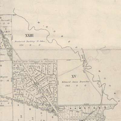
KISSING COUSINS AT GLENROY, VIC., AUST. IS THAT WISE MAN?
WISEMAN?WISEMAN. ? On the 24th August, 1910,at St. Matthew's Church of England, Glenroy, by the Rev. E. V. Wade, Arthur Ernest, youngest son of the late Albert Wiseman, of Glenroy, to Alice, youngest daughter of the late Arthur Wiseman, of Glenroy. At home, Ashworth (*SIC?), Glenroy, Friday, 2nd December.(P.1, Argus,29-11-1910.)
*I have found no other mention of Ashworth,Glenroy,in family notices or advertisements so I presume this is meant to be Ashleigh.
The Argus (Melbourne, Vic. : 1848 - 1957) Friday 23 September 1892 p 1 Family Notices
WISEMAN - On the 21st inst., at his late residence, 'Sawbridgeworth,' Glenroy, Arthur
The Argus (Melbourne, Vic. : 1848 - 1957) Monday 30 August 1920 p 1 Family Notices
... . WISEMAN. On the 28th August, at "Ashleigh," Glenroy. Hannah, widow of the late Albert Wiseman.
P.81, BROADMEADOWS: A FORGOTTEN HISTORY.
The principals of the firm (Glenroy Land Co.) were Frank Stuart, John McCutcheon,and Arthur and Albert Wiseman, dividing half the shares between them.Arthur and Albert and a third brother,William had been enjoying the land boom thoroughly.
KOWARZIK/ KAY OF "STRATHCONAN", TULLAMARINE, VICTORIA, AUSTRALIA.
KOWARZIK —PALMER. —Lorraine, only daughter of Mr. and Mrs. F. F. Kowarzik, Tullamarine, to Eric,only son of Mr. and Mrs. C. Palmer, Tullamarine.(ENGAGEMENTS. P.8, Argus, 7-2-1948.)
Both families were on Old Broadmeadows Rd, since renamed Mickleham Rd, probably when the road was constructed north of Forman St to cross the Moonee Ponds Creek because of the bottleneck caused near the Broadmeadows Hotel when cars had to turn left up the Ardlie St hill to reach Mickleham Rd.
The Palmers had John Mansfield's former "Grandview", the southern 169 acres of "Viewpoint" fronting the east side of the road with the north boundary near Finningley Drive and the south boundary adjoining Camp Hill Park in Melway 15 J1. Kowarzik had "Strathconan", 142 acres bounded by the Freight Rd/ Londrew Court midline (S), the line of Derby St (SW) and Mickleham Rd north to about the McDonalds site.
Having been acting manager of Australian National Airways, F.Kowarzik had become general manager by 1952.
F.KOWARZIC
The name of the owner of Strathconan in Broadmeadows rate records soon after changed to Kay. I can't recall who it was that told me he had been pressured to change his name, possibly Keith McNab. He'd become F.Kay by 1955!
Mr. F. Kay, A.N.A. general manager, said his company's tourist class service would operate from October 2
with DC-4 Skymasters seating 60 passengers. (P.5, Argus, 21-9-1955.)
FROM WIKIPEDIA (AUSTRALIAN NATIONAL AIRWAYS.)
Takeover by Ansett Transport Industries
After initially dismissing his offer, the ANA board began talking with Reginald Ansett, head of the much smaller Ansett Transport Industries; with its main interstate operation Ansett Airways. Finally, ANA was sold to Ansett, on 3 October 1957, for £3.3 million. The two airlines were merged to form Ansett-ANA on 21 October 1957[9] and the name was retained until 1 November 1968 when it was renamed Ansett Airlines of Australia.
Frederic Kowarzik's sister, Anne, married Ted Dalley, a descendant of Samuel Dalley a Hawthorn pioneer in 1852.
FROM ted dalley*s story - Hawthorn Historical Society
hawthornhistoricalsociety.com.au/images/hhs/Downloads/teddalley.docx
Charles married Sarah Power, the daughter of Thomas Power, another Hawthorn pioneer, at the family home Denmark Hill, Upper Hawthorn. They had six children; one of whom, Selina, married Albert Hatherley of Hatherley & Horsfield paint merchants of Burwood Road, Hawthorn. Charles & Sarah’s youngest son was Harry Power Dalley, the father of Ted, who married Anne Kowarzik . Anne’s brother Frederic became managing director of Australian National Airlines.
Frederic Ferdinand Kowarzik was on "Strathconan" by 1946.
JOHN WALLIS MURRAY. Late of 36 Waterdale Road,- Ivanhoe, Chief Steward, Deceased.-After fourteen clear days we, Charles Fairfax Telford, of Kyneton, contractor, and Frederic Ferdinand Kowarzik, of Broadmeadows road,
Tullamarine, the executors appointed by deceased's will (dated the 14th day of January, 1941) will APPLY to the
Supreme Court for grant of PROBATE of the said WILL.(P.22, Argus, 3-7-1946.)
HOBBS - KOWARZIK. - June, only daughter of Mr. and Mrs. Hobbs, of Douglas, to Ken, only son of Mr. and Mrs.F.F. Kowarzik, of Tullamarine. (ENGAGEMENTS, P.8, Argus, 9-11-1946.)
Having been born at Traralgon in 1898, Frederic was of an age to enlist in W.W.1.
EventBirth Event registration number7089 Registration year1898
Personal information
Family nameKOWARZIK Given namesFrederic Ferdinand SexMale Father's nameEdmund Mother's nameJanet (Wilson) Place of birthTRARALGON
Frederick Ferdinand KOWARZIK
Regimental number 1220
Place of birth Traralgon Victoria
Religion Presbyterian
Occupation Operator
Address Drouin, Victoria
Marital status Single
Age at embarkation 18
Next of kin Father, E Kowarzik, Drouin, Victoria
Enlistment date 4 February 1916
Rank on enlistment Private
Unit name 37th Battalion, D Company
AWM Embarkation Roll number 23/54/1
Embarkation details Unit embarked from Melbourne, Victoria, on board HMAT A34 Persic on 3 June 1916
Rank from Nominal Roll Corporal
Unit from Nominal Roll 3rd Divisional Signal Company
Fate Effective abroad (still overseas)*
*PHOTO OF FREDERIC WITH FURTHER SERVICE RECORD DETAILS (but his father's name is wrongly given as Frederick.)
Ko-Kz - WWI Pictorial Honour Roll of Victorians
ww1vic.gravesecrets.net/ko-kz.html
FREDERIC WAS MARRIED IN 1925.
EventMarriage Event registration number9313 Registration year1925
Personal information
Family nameKOWARZIK Given namesFrederick Ferdinand SexUnknown Spouse's family nameTHYER Spouse's given namesNorma Elaine
Charles Palmer and Frederick sold their Tullamarine farms (as shown in the map on page 196 of Andrew Lemon's BROADMEADOWS A FORGOTTEN HISTORY)to Stanley Korman in the 1950's and while Charles Palmer's widow was still living in the homestead of their farm in 1973, Frederick Kay had probably moved away in 1957 when Reg. Ansett bought Australian National Airways.